After a few days of watching the NWS Snowcasts I think I see how they operate.
The NWS FORECAST is based on the forecast of precip, the same (?) as GRT, but then
as actual snow depth is recorded the NWS snowcast updates their hind cast values
to reflect their observed snow gages for a better forecast of melt. This
is where I'm missing the boat. GRT needs to use the NWS hindcast SWE
for start ups or
find an airport or heated gage for a corrected G/R ratio adjust of radar precip.
One could run the SNOWCAST setup first followed by GRT's snowmelt calc using the
same DSID for both SWE (but not Melt) but I won't yet for comparisons here.
IMPORTANT! Make sure your Forecast temps agree with your gage history by
using 'Run-'
Forecast-NWS and compare the forecast TRACES with history. I've already seen this make a 0.8" forecast snowpack be rain instead as
was correctly predicted
by the Tnws. There may be even more to this Snowcast Temp 'Forcing' story.
RESULTS SO FAR:
The NWS (nohrsc) snow forecast and history data can shift all over and so I
would use several melts for your location to calibrate GRT and use GRT for more
consistant results. Depending on the site the NWS precip may be more
reliable for unadjustable radar and/or distant winter overshoot (BC California
foothills). And I think the NWS-7day forecast data is more reliable than
the NWS (nohrsc) 2day forecasts. This is all my subjective analysis w/o
heated rain gages at the sites.
Yeah well you know that's just like ah your opinion man.
Links to the web pages used in this studay:
MC=Massies Creek, OH
OC=Oneida Creek, NY
SC=Slate Creek, KS
RC=Rapid Creek, SD
WC=Willow Creek, SD
RR=Rush River, ND
BC=Big Creek, CA
NOTE ALL TIMES ARE FOR MY PACIFIC TIME ZONE
NWS=modeled data from NOAA's National Operational Hydrologic Remote Sensing
Center's Interactive Snow Information: For history they update their
model data some how at some time:
https://www.nohrsc.noaa.gov/interactive/html/map.html
GRT=NWS 7 day forecast with Adjusted (for snow airport only gage) A2M Radar
(multi radar multi sensor) for History.
Performance of NWS (NOHRSC) Snowcasts of Melt and SWE vs GetRealTime
(NWS 7-day):
|
Basin Run |
NWS
(nohrsc)
SWE
Forecast |
GRT(nws) SWE Forecast |
NWS MELT
Forecast |
GRT
MELT
Forecast |
Best
Overall |
2020
MC Dec 2 |
Fair |
Good |
G |
G |
GRT; |
|
MC Dec 3 |
G |
P |
G |
F |
NWS; |
|
MC Dec 4 |
P |
G |
P |
G |
GRT; |
|
MC Dec 5 |
G |
G |
P |
G |
GRT; |
|
|
|
|
|
|
|
|
OC Dec 10 |
G |
G |
G |
G |
NWS; bad
GRT radar precip |
|
OC Dec 11 |
G |
G |
P |
G |
GRT; |
|
|
|
|
|
|
|
|
BC Dec 11-12 |
G |
P |
G |
P |
NWS; |
|
BC |
-- |
-- |
-- |
-- |
GRT
had low forecast Temp... maybe. |
|
|
|
|
|
|
|
|
SC Dec 13-19 |
G |
G |
F |
G |
GRT; more ending NWS melt than snowpack
then fixed and |
|
|
|
|
|
|
has higher temperatures for faster melt than GRT. |
|
OC Dec 16-24 |
G |
G |
G |
F |
NWS; GRT had slower melt after resetting LRadiation to 1. |
|
|
|
|
|
|
|
|
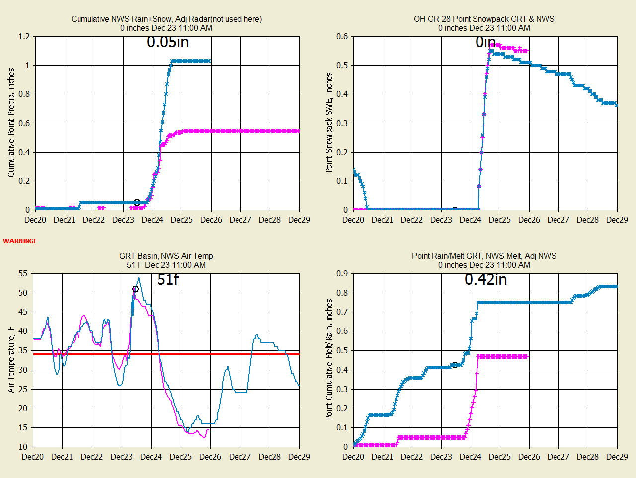
MC Dec 16-23 |
P |
G |
P |
G |
GRT; low NWS precip forecast;
NWS snowpack vanished. |
|
|
|
|
|
|
|
|
WC Dec 22-Mar
3 |
? |
? |
F |
F |
GRT forecasts much better melting temperatures.
GRT late. |
|
|
|
|
|
|
|
|
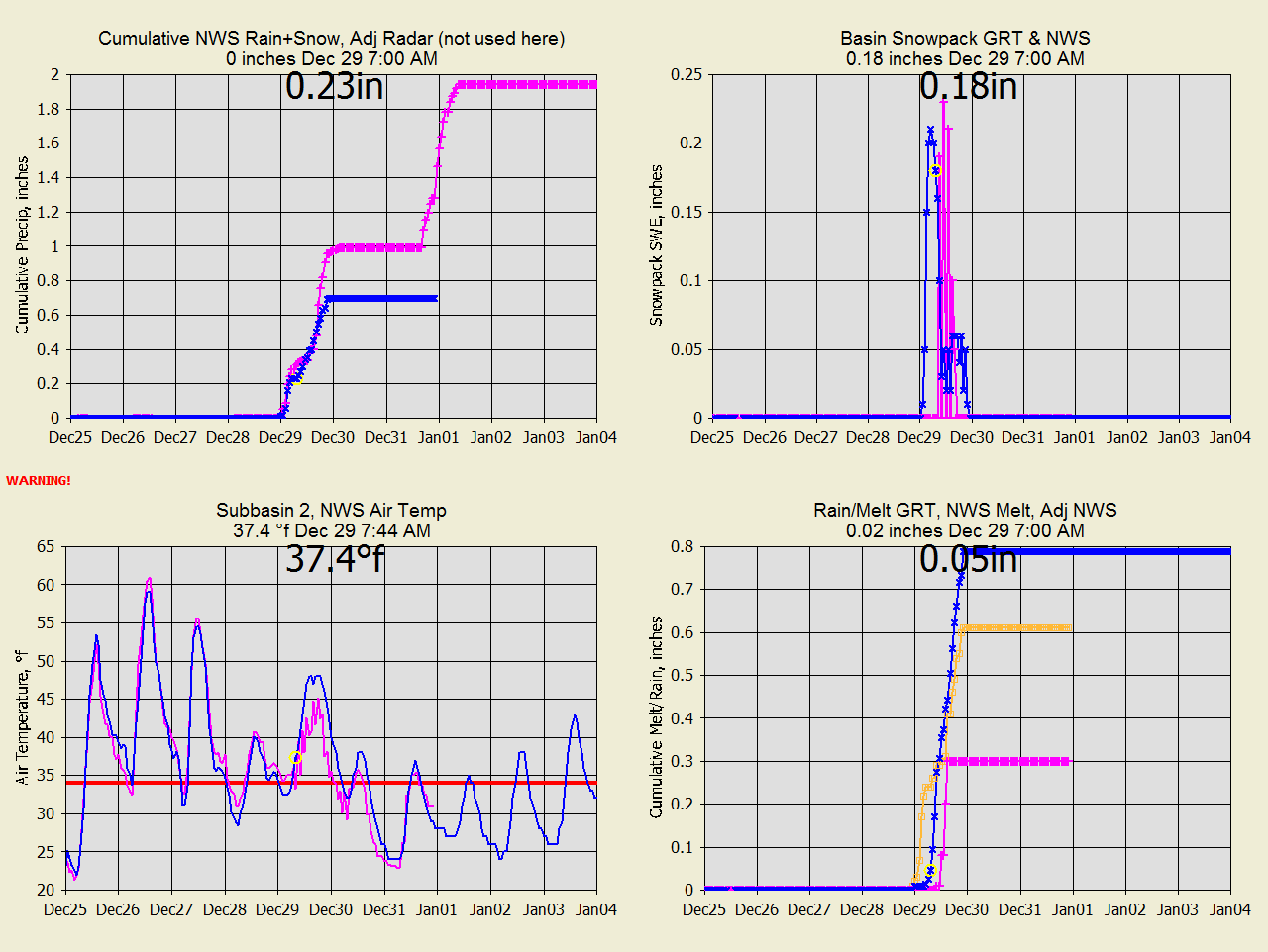
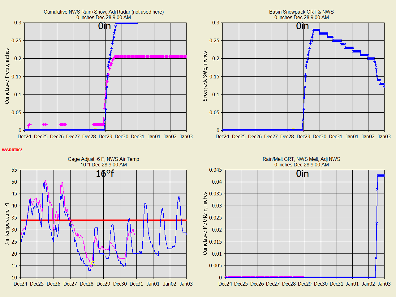
SC Dec 28-Jan
4 |
P |
F |
P |
G |
GRT; NWS forecast precip is 1/2 of GRT and GRT was
|
|
|
|
|
|
|
low
based on runoff. NWS bad melt at 47F. |
|
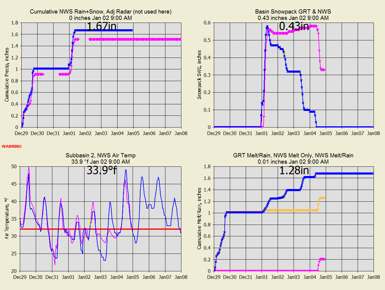
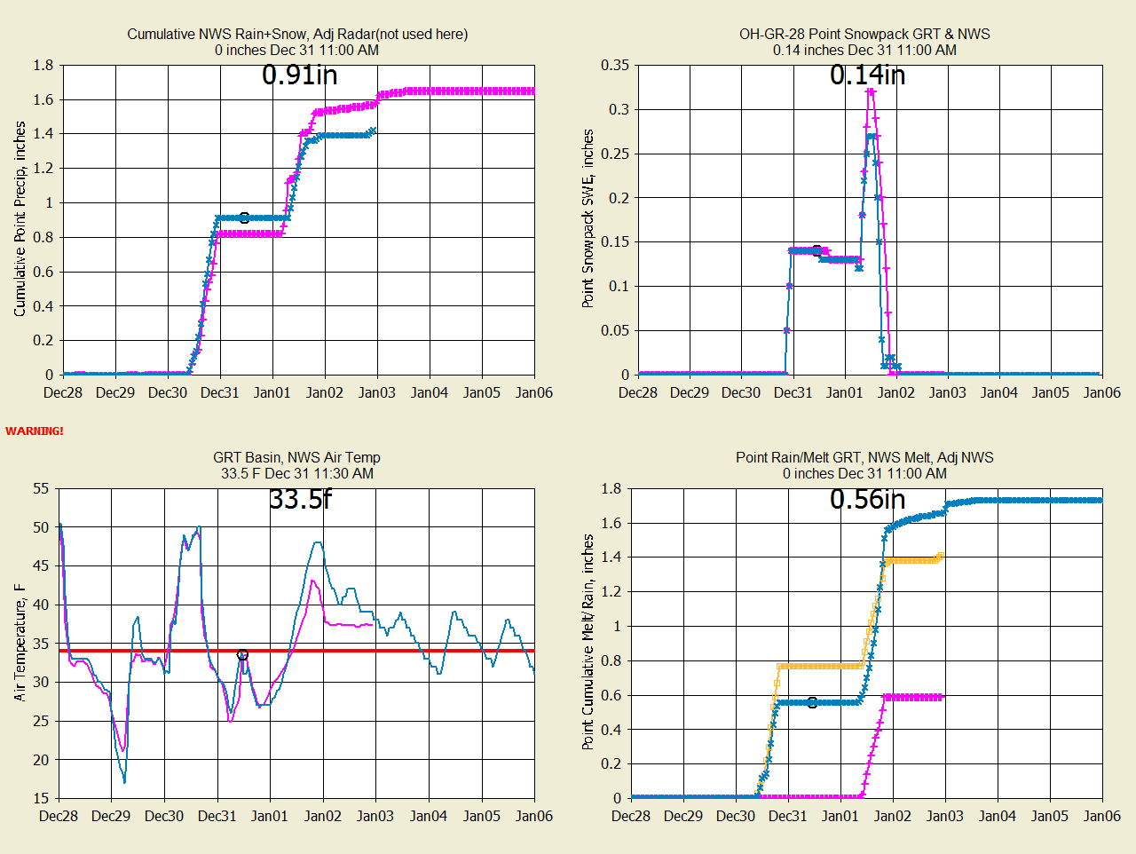
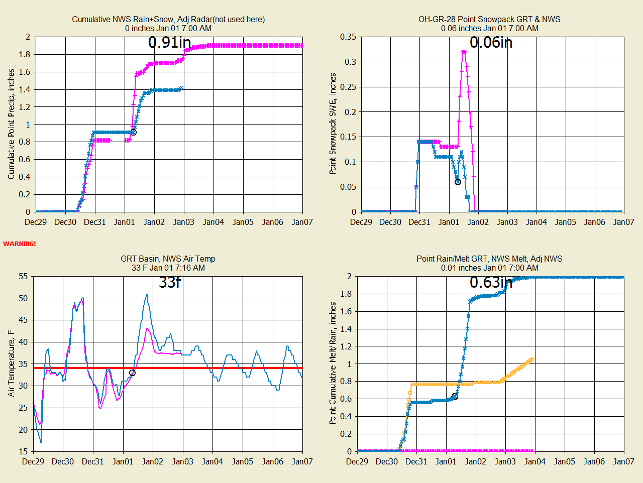
RC Dec 28-30 |
P |
G |
G |
G |
GRT; NWS doesnt give tomorrow's SWE. Too high precip.
|
|
|
|
|
|
|
|
|
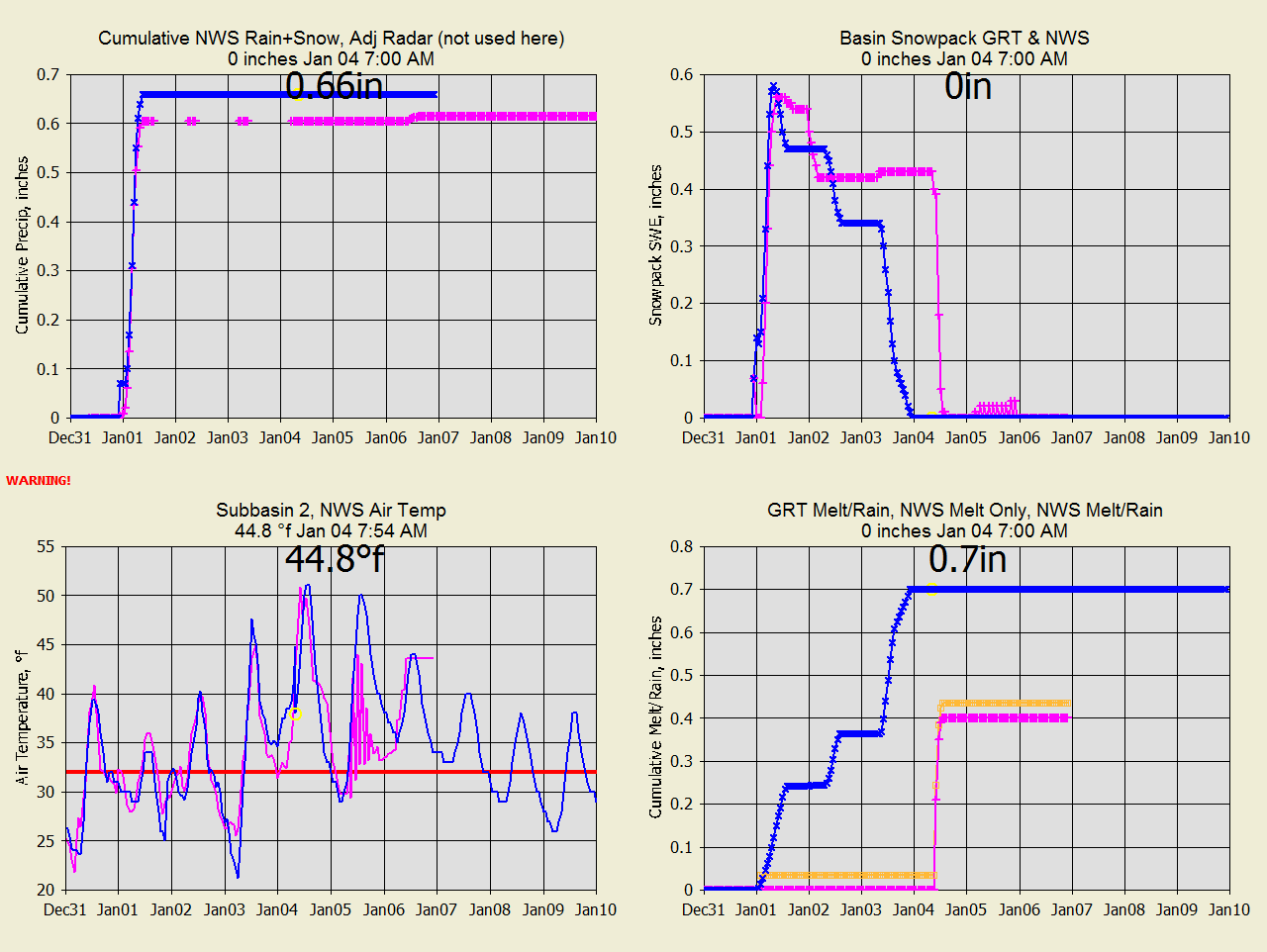
MC Dec 31-Jan
4 |
F |
F |
P |
F |
GRT; NWS has no melt at 50F.
The NWS was out all night. |
|
|
|
|
|
|
|
|
RR Jan 12-Feb
22 |
P |
G |
P |
G |
GRT; NWS precip forecast bad. NWS bad melt. |
|
|
|
|
|
|
|
|
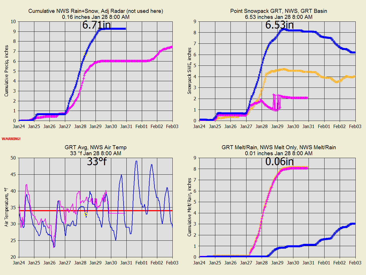
BC Jan 26 |
G |
G |
E |
P |
NWS had correct temperatures (just in California).
I adjusted |
|
|
|
|
|
|
Temps +-0.25F either all melt or all snow. +5.75F all melt. |
|
|
|
|
|
|
|
|
SC Feb 6-Feb 22 |
P |
G |
G |
G |
GRT: GRT
A2M unadjust radar better. Both melts fine. |
|
|
|
|
|
|
|
|
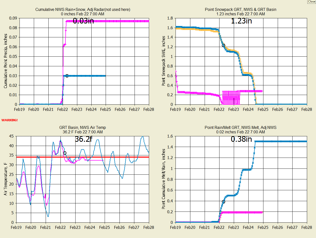
MC Feb 22. |
P |
G |
P |
G |
GRT: NWS has little snowpack but pics say otherwise. |
|
|
|
|
|
|
|
|
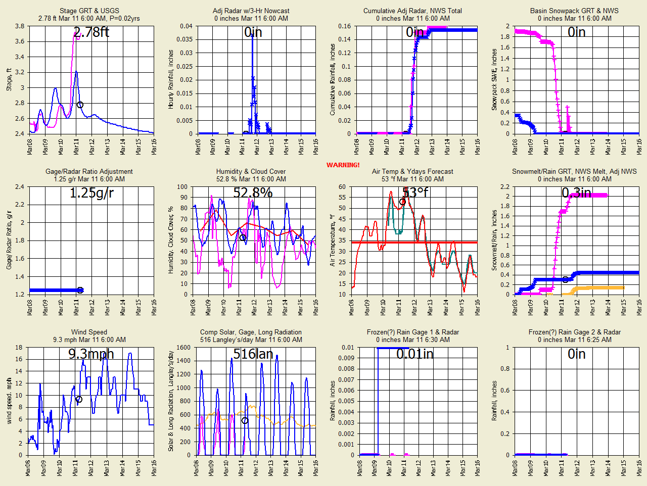
OC Dec 10-Mar 11 |
G |
P |
P |
G |
NWS has twice snowpack. Waiting for melt.
Watch stage. |
|
|
|
|
|
|
NWS had correct snowpack at 2 * GRT. Bad radar. But |
|
|
|
|
|
|
GRT had correct melt pattern of final week based on runoff |
|
|
|
|
|
|
gage and web cam. |
|
|
|
|
|
|
xxxxxxxxxxxxxxxxxxxxxxxxxxxxxxxxxxxxxxxxxxxxxxxxxxxxx |
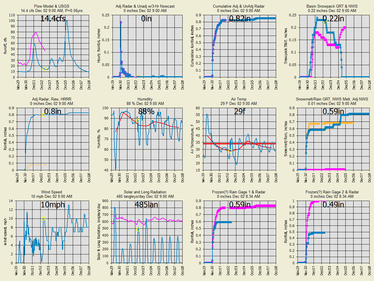
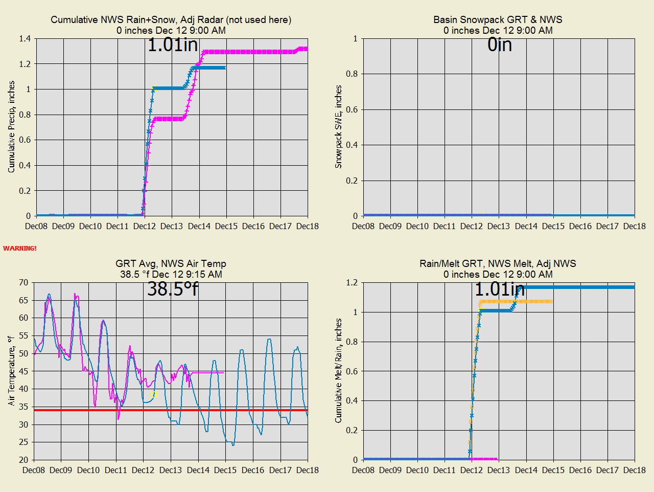
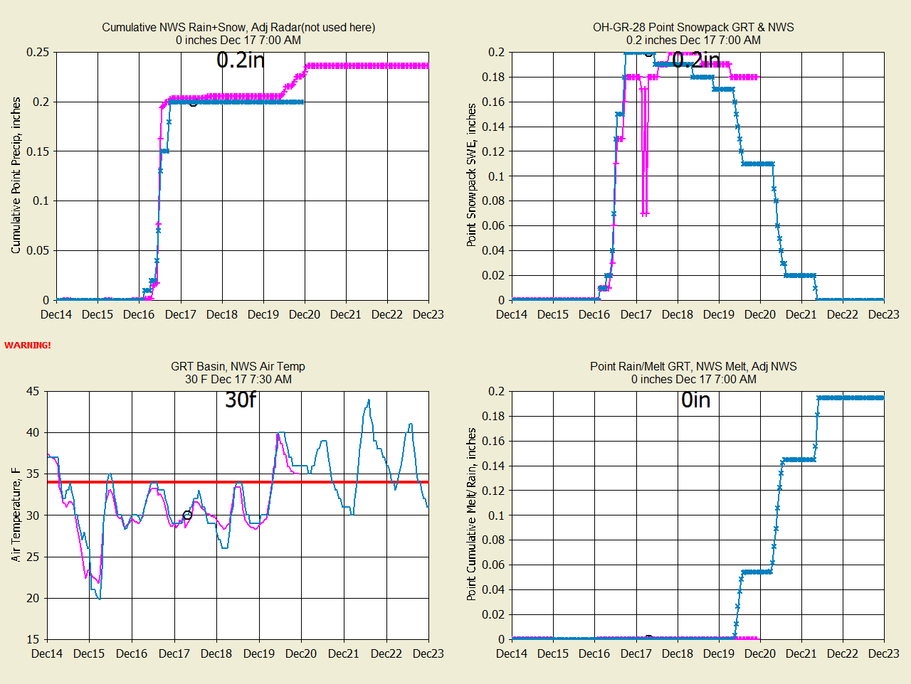
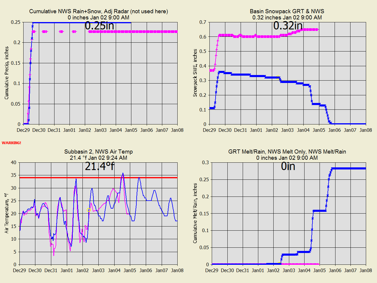
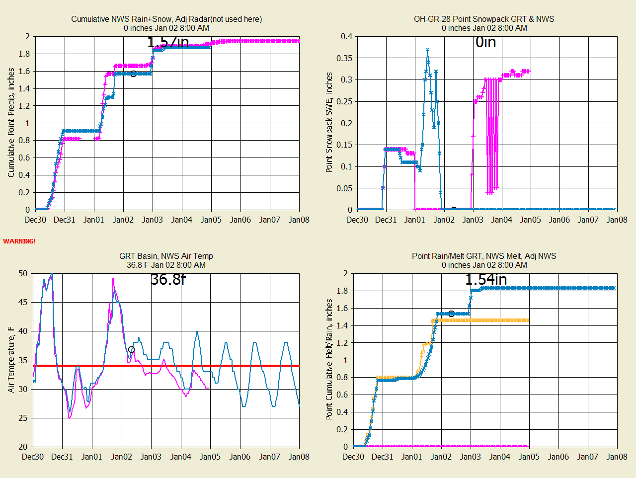
MC Dec 2, 2020
NWS is adding swe on Dec 4 forecast when there is no precip.
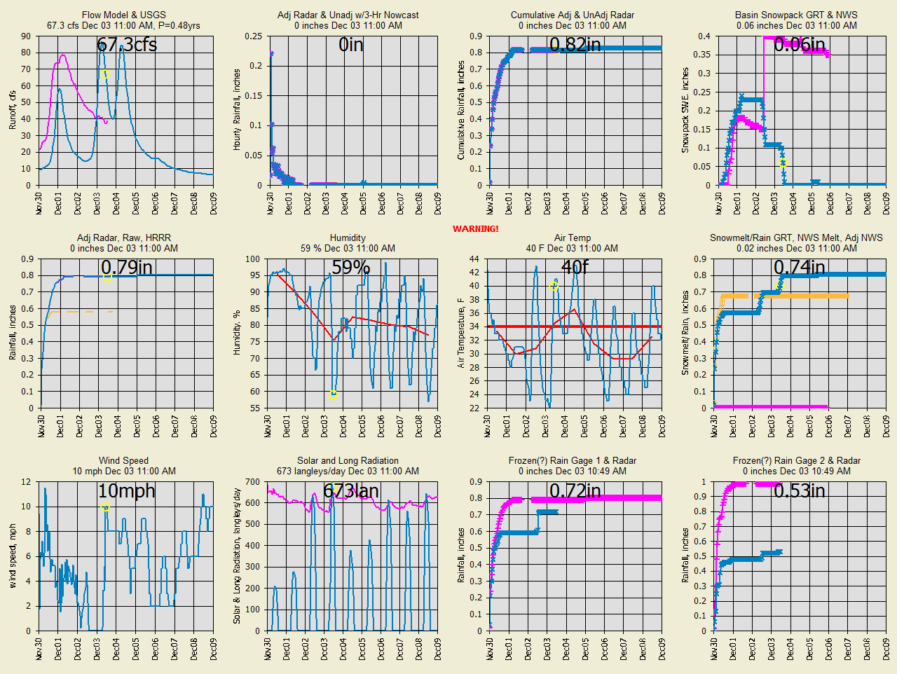
MC Dec 3, 2020
NWS swe history/forecast changes by +0.25" for Dec 2.
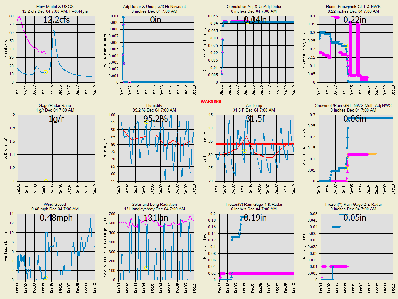
MC Dec 4, 2020
NWS swe history/forecast changes are irratic.
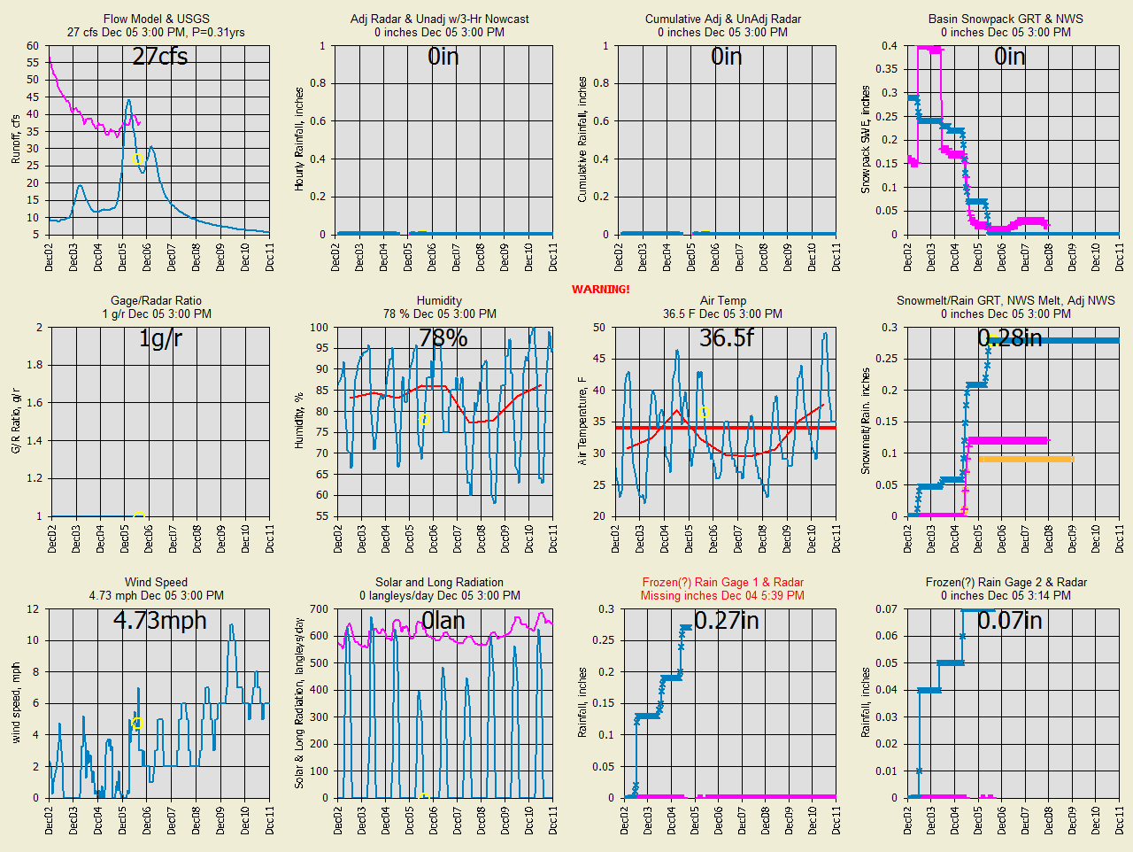
MC Dec 5, 2020
NWS swe history/forecast updates their hind cast values for start up.
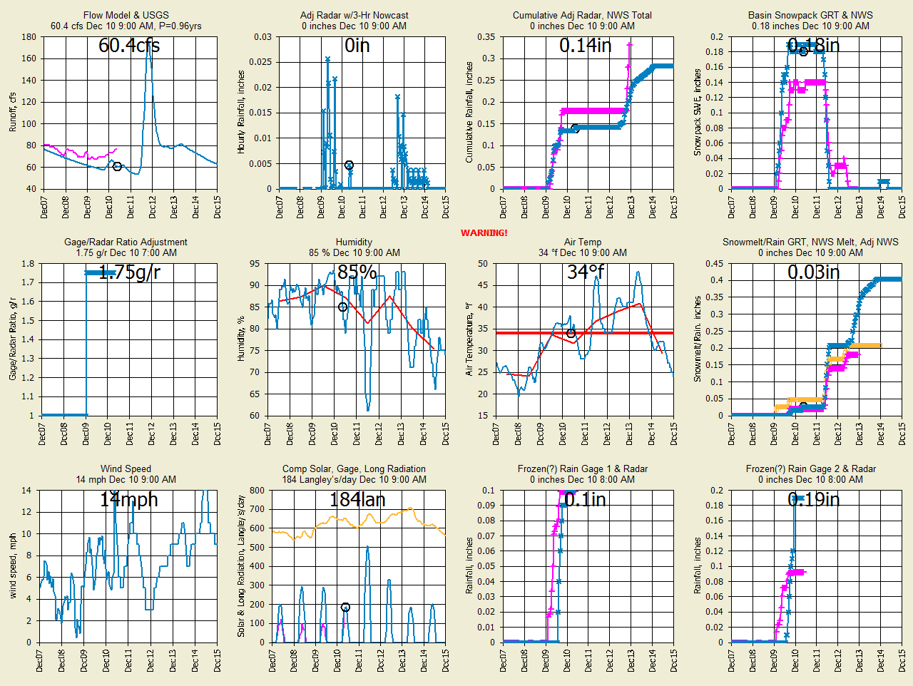
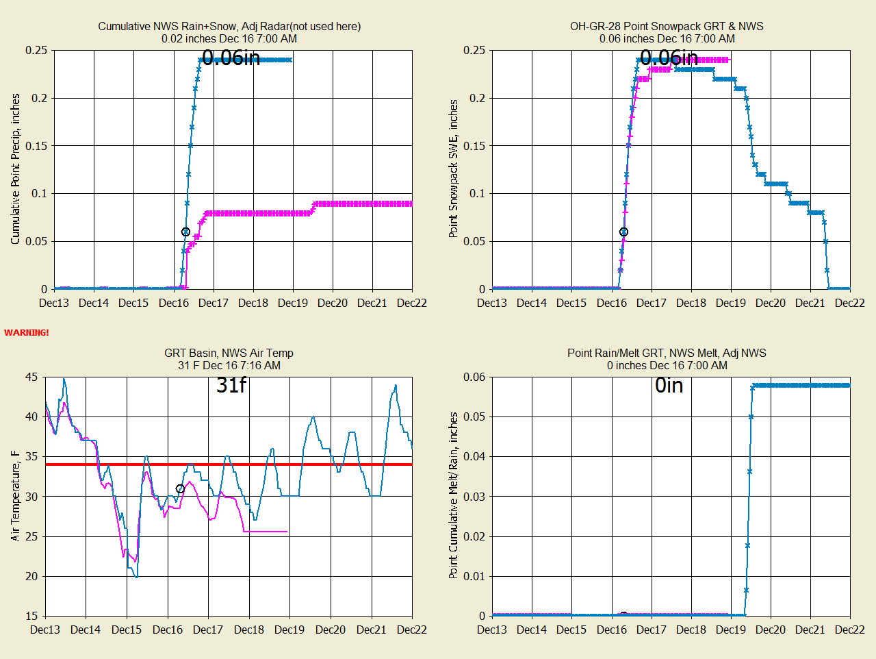
OC Dec 10, 2020
GRT's A2M radar was grossly under the NWS rain+snow so I adjusted by 1.75*radar.
Sometime in the future I will replace the A2M radar snowfall with NWS Point
rain+snow and overwrite with 7 day forecast.
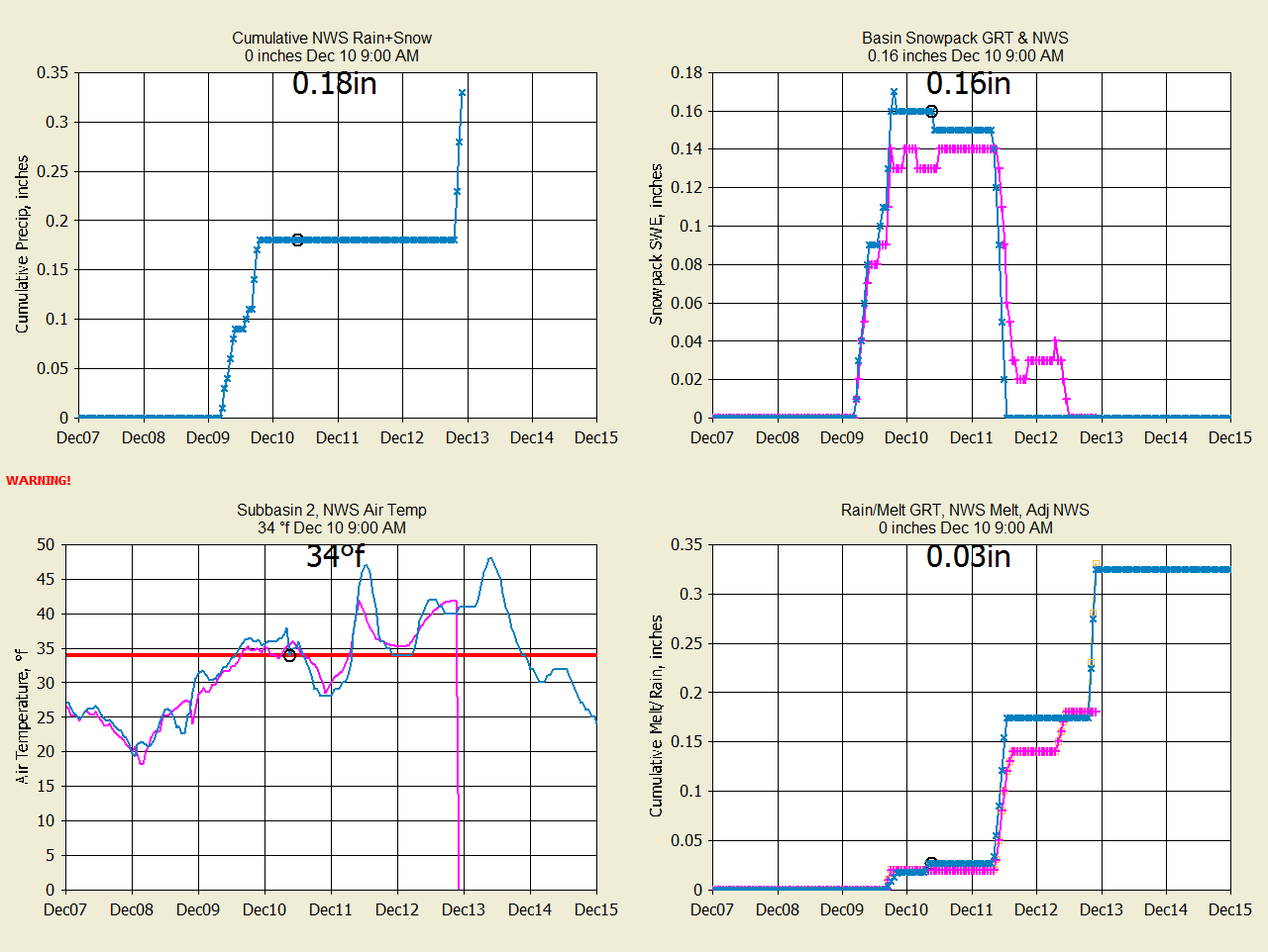
OC Dec 10, 2020 New graph at NWS point for better comparisons. GRT's
temperature forecast was adjusted T-3f.
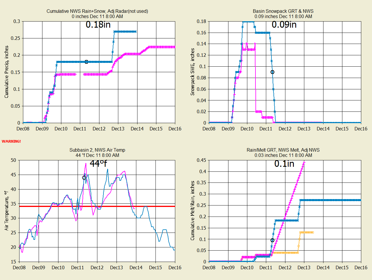
OC Dec 11 GRT forecast Temp turned out better than Snowcast. Snowcast has
crazy melt on Dec 10.
BC Dec 11, 2020 Big difference in forecast Temp where Snowcast says No Snow:
BC Dec 12 The
Snowcast temperature was correct and no snow fell. How did they know that
the public NWS forecast of midnight temperature was too low? I need to
compare Forecast-NWS Run traces with gage history and maybe adjust the morning
lows.
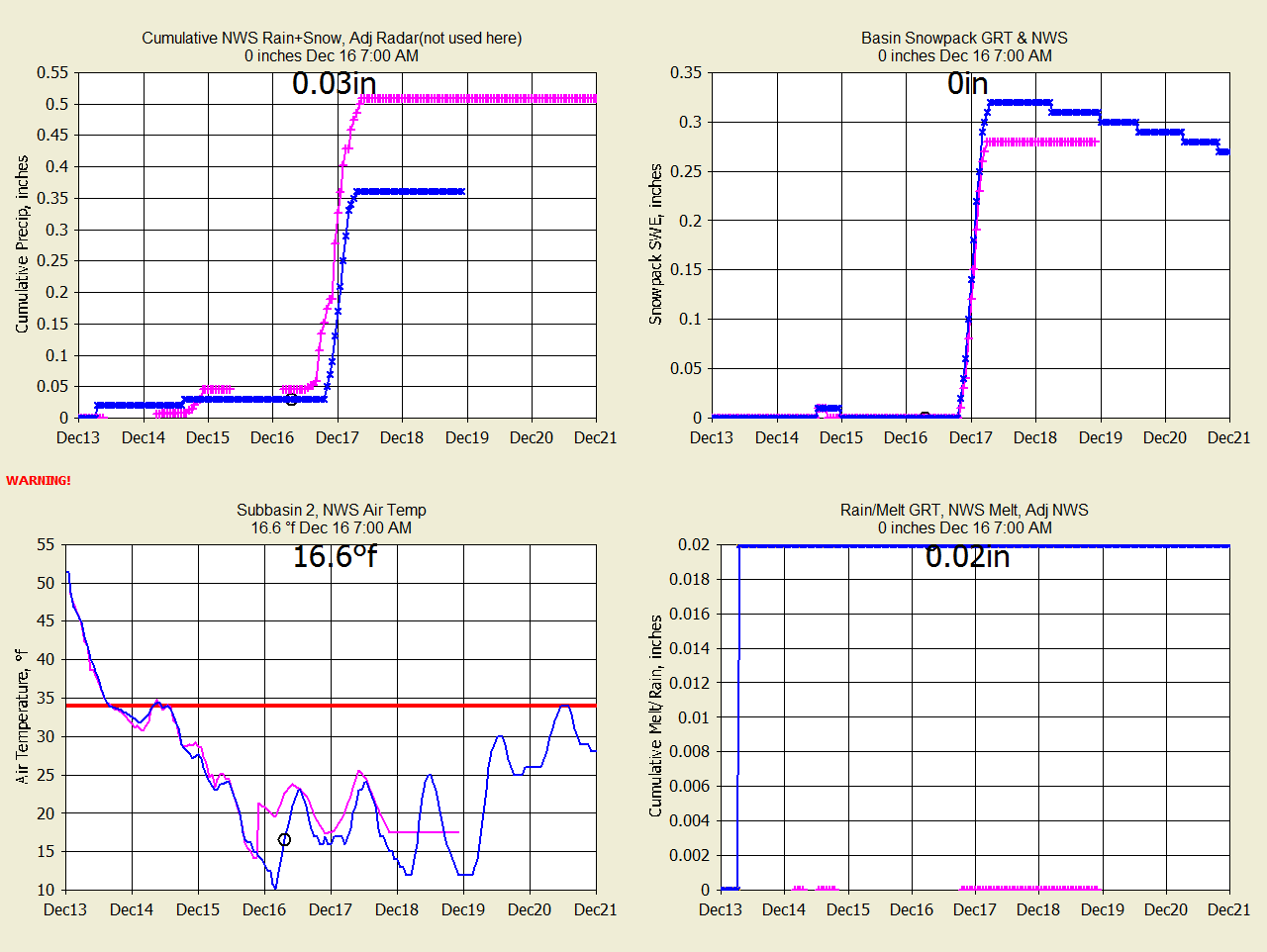
SC Dec 15, 2020 I deleted my run/trace info so only the melt will be judged
here.
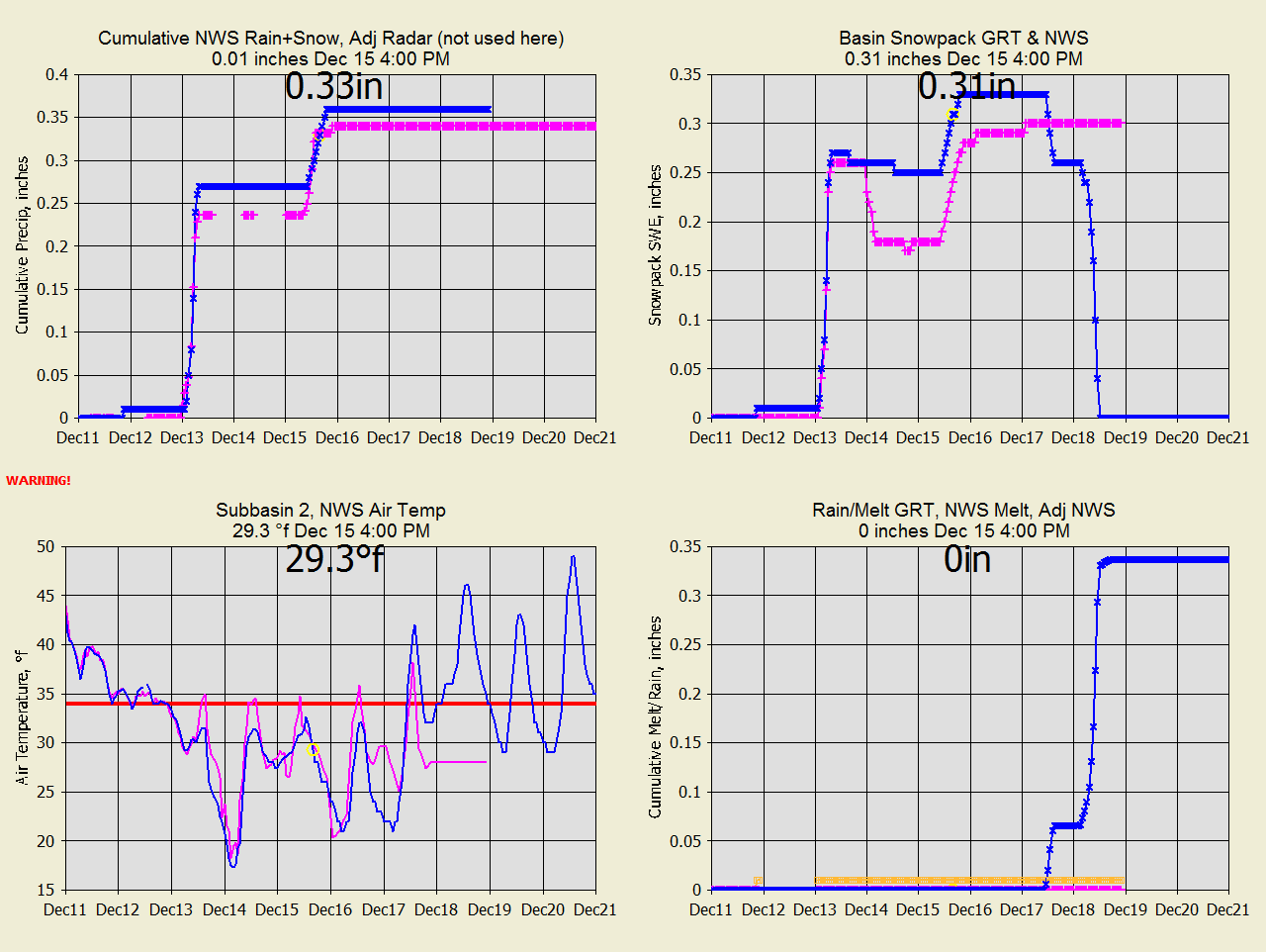
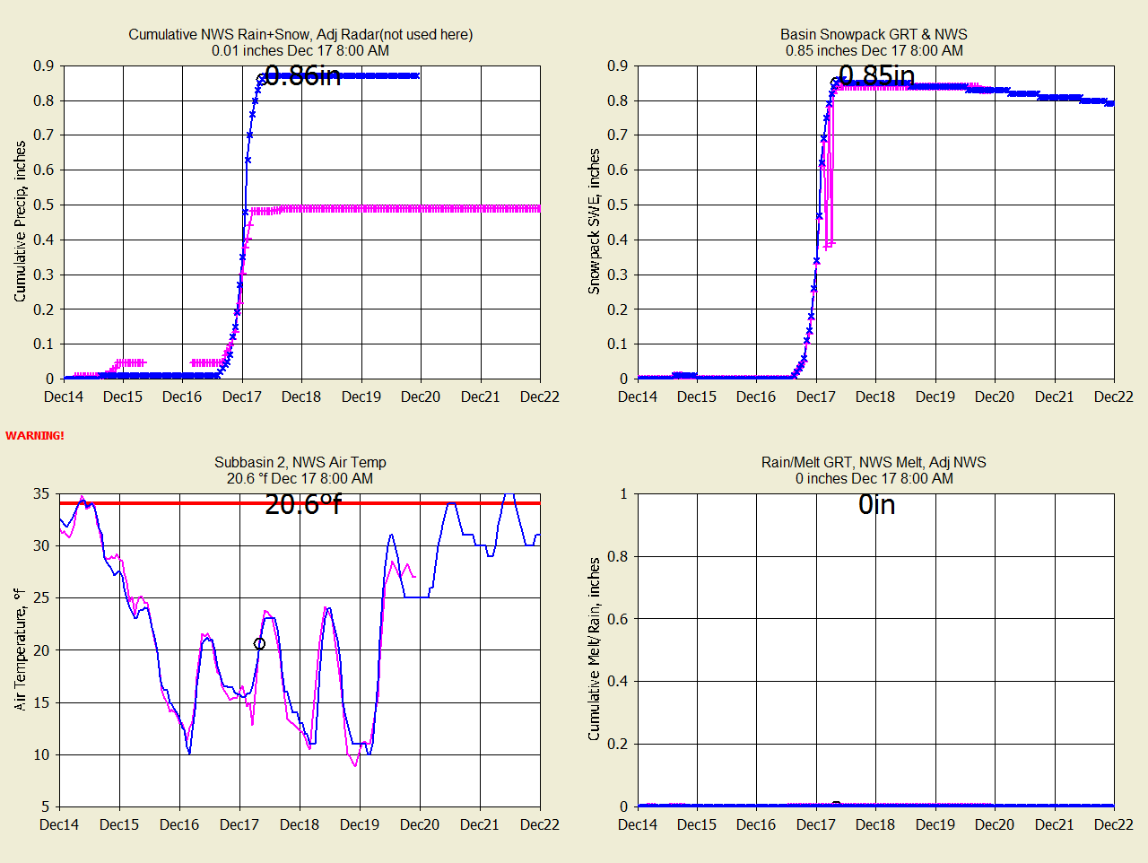
SC Dec 16, 2020 No change yet.
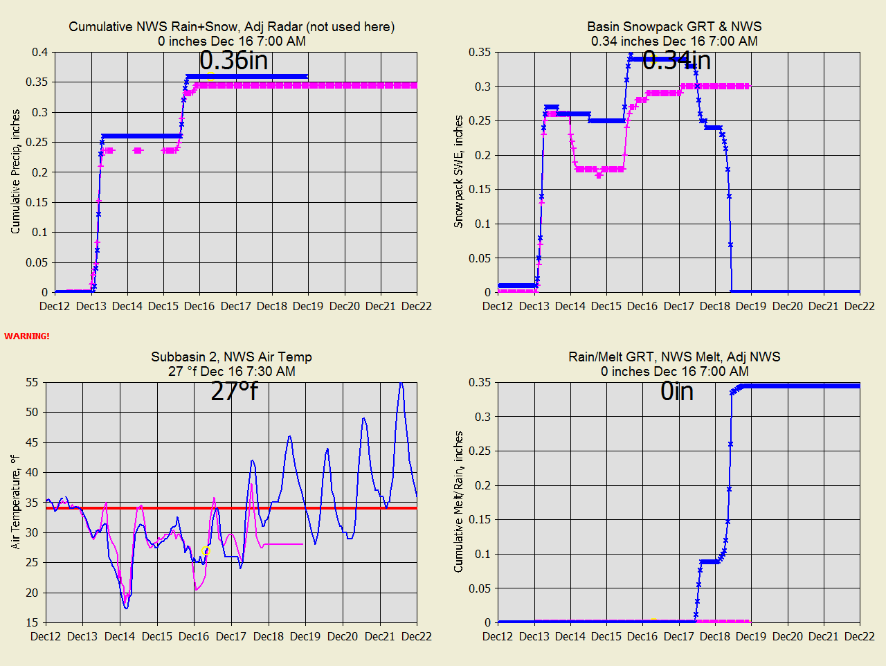
SC Dec 17, 2020 No
melt yet but NWS melt is screwy but adjusted for no snow is fine.
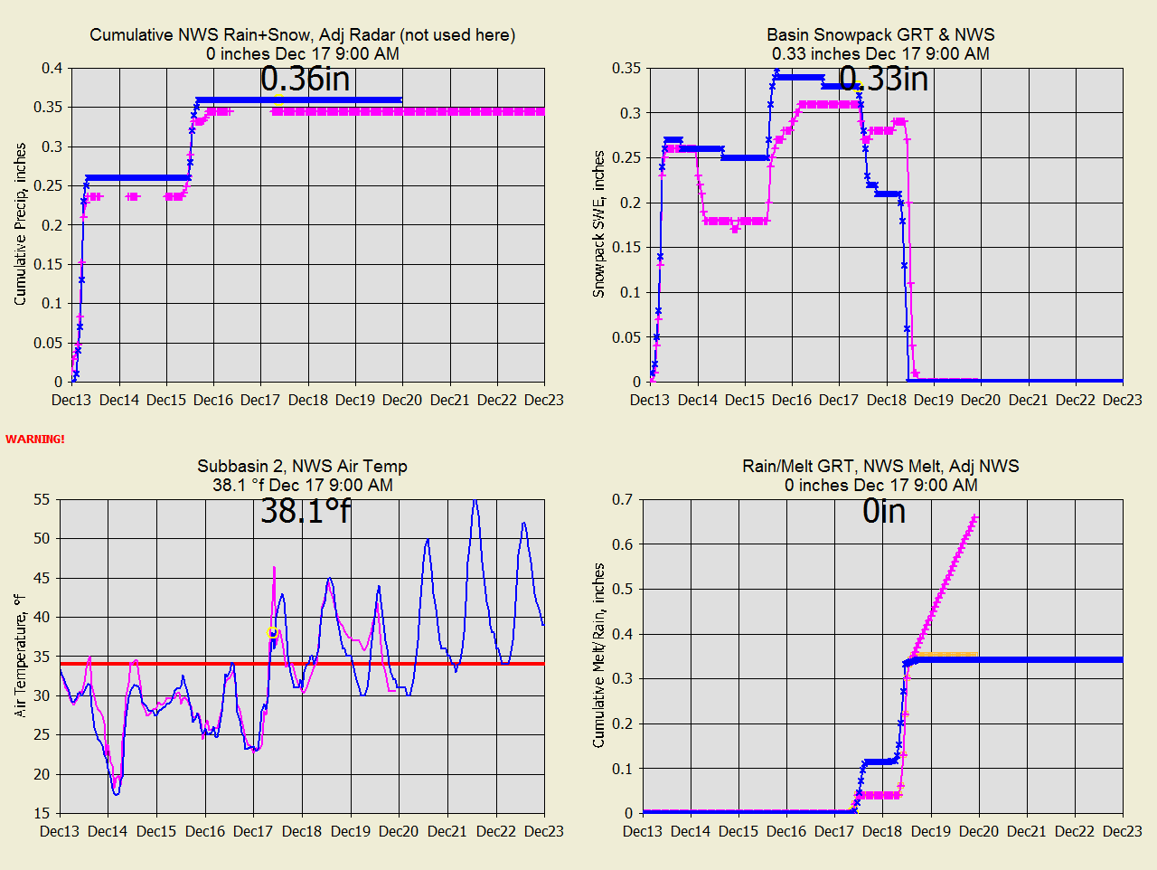
SC Dec 18, 2020 Melt agreeded well until last few hours where NWS
(orange) picked up 19%
more melt that snowpack.
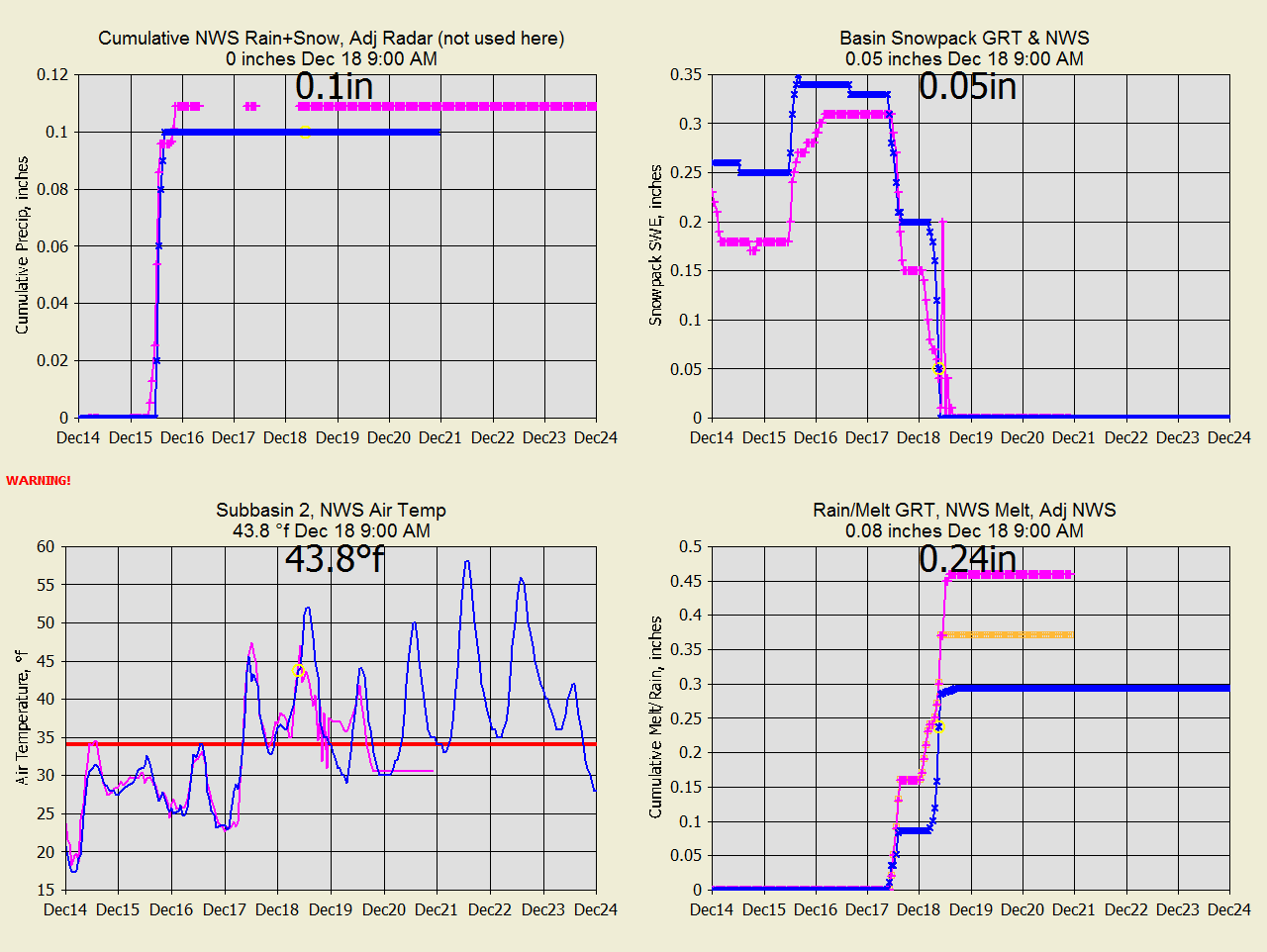
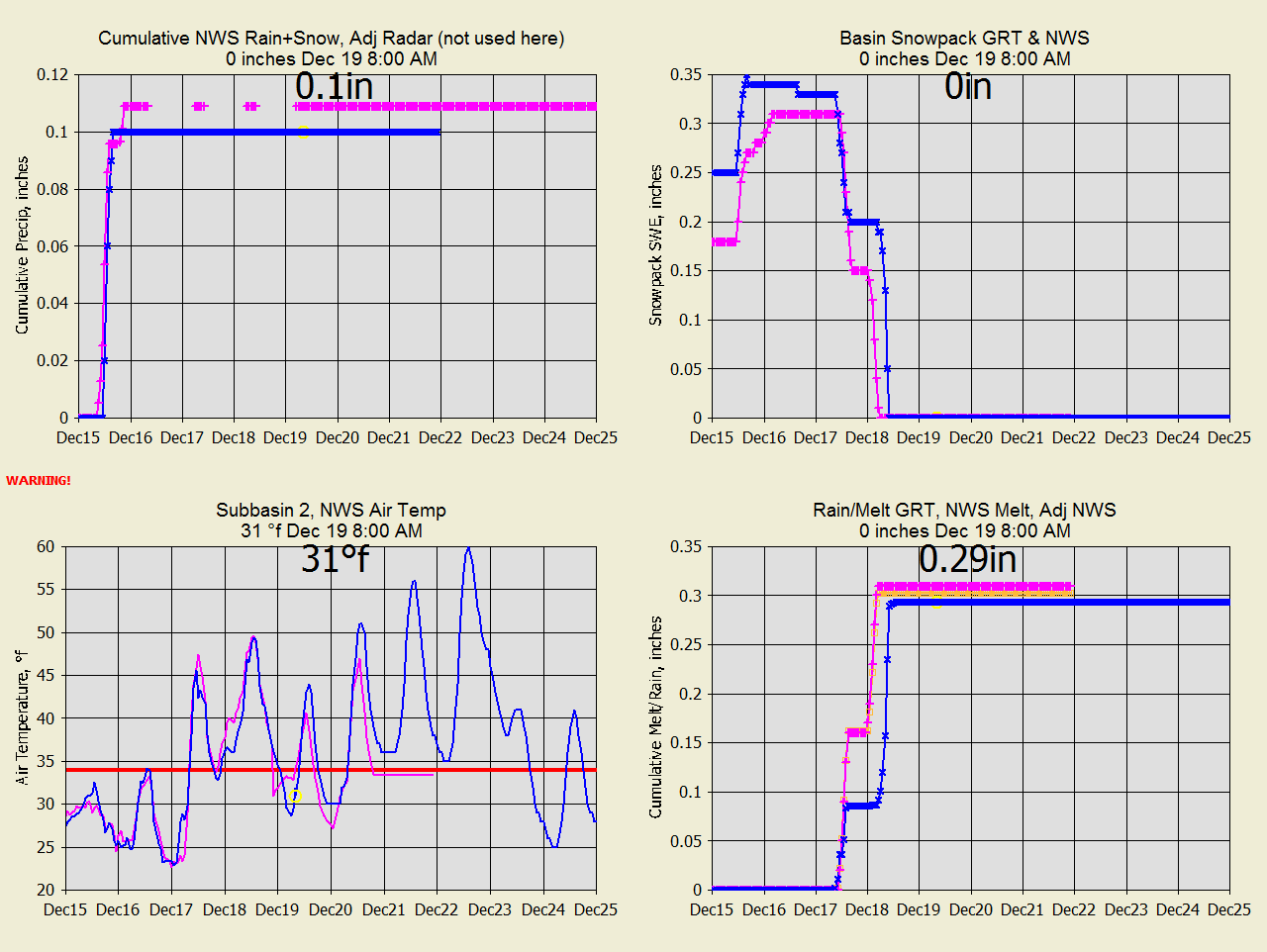
SC Dec 19, 2020 NWS faster melt with higher temperature.
OC Dec 16 Different forecasts for precip as usual. Don't these guys
at the NWS talk to each other?
OC Dec 17
GRT actual precip radar adjusted from Syracuse Airport, so who is right?
The creek is frozen so who knows what that will say.
OC Dec 23 Big melt tomorrow with matching melt rates.
OC Dec 24
Change in forecast Temps. GRT slower forecast melt.
OC Dec 25
Change in forecast Temps. GRT slower forecast melt.
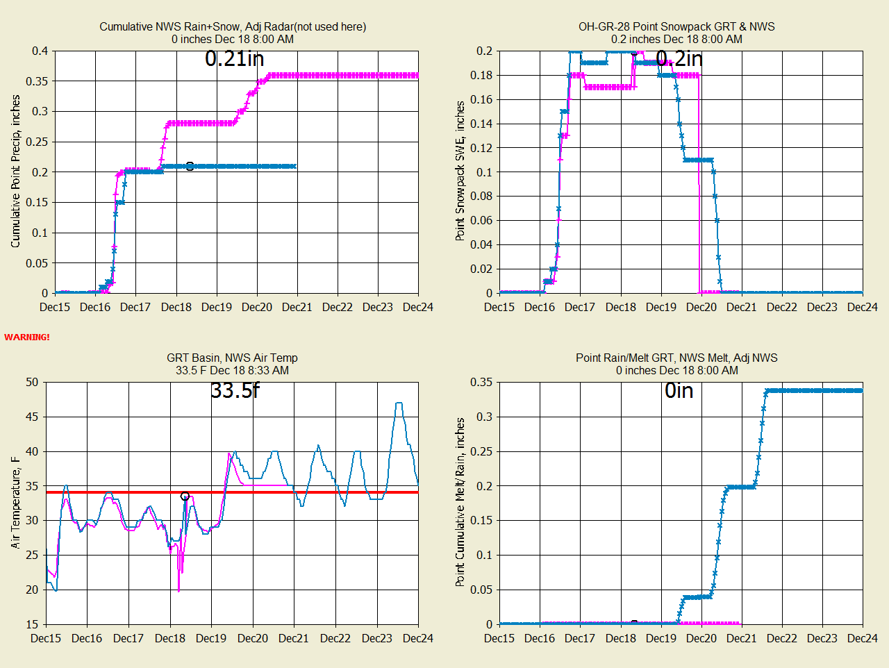
MC-Dec 16 Different precip forecasts and temperatures.
MC-Dec 17
The history shows that both precip agrees with the GRT(nws) forecast.
MC-Dec 18
Precip radar difference on Dec 17 and forecast precip difference Dec 19.
No NWS melt forecast.
MC-Dec 19
NWS shows no melt for 20-21 with lower temperatures. NWS lost it's Dec 18
snowpack.
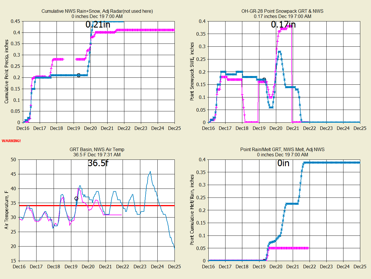
MC-Dec 23
The NWS snowpack of Dec 20 just disappeared with no melt.
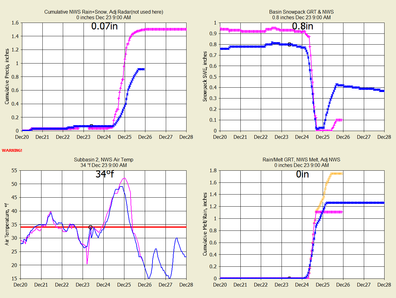
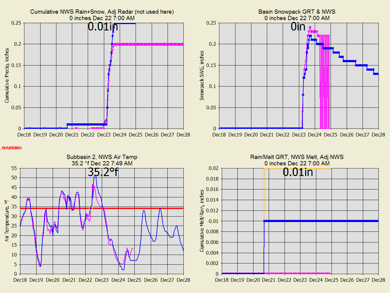
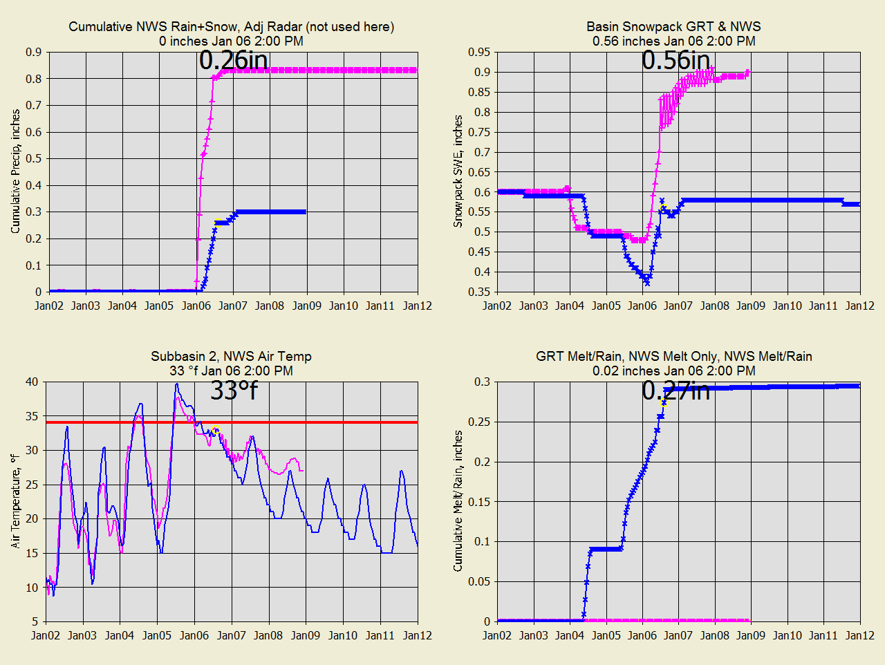
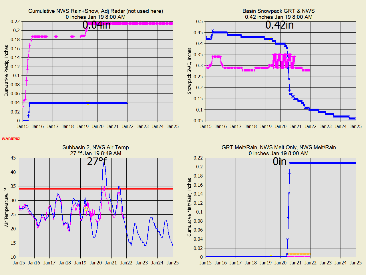
WC-Dec 22 NWS Snowcast and NWS Forecast precip within 20% (.05").
Temp diff at 34F Dec 23 00:00.
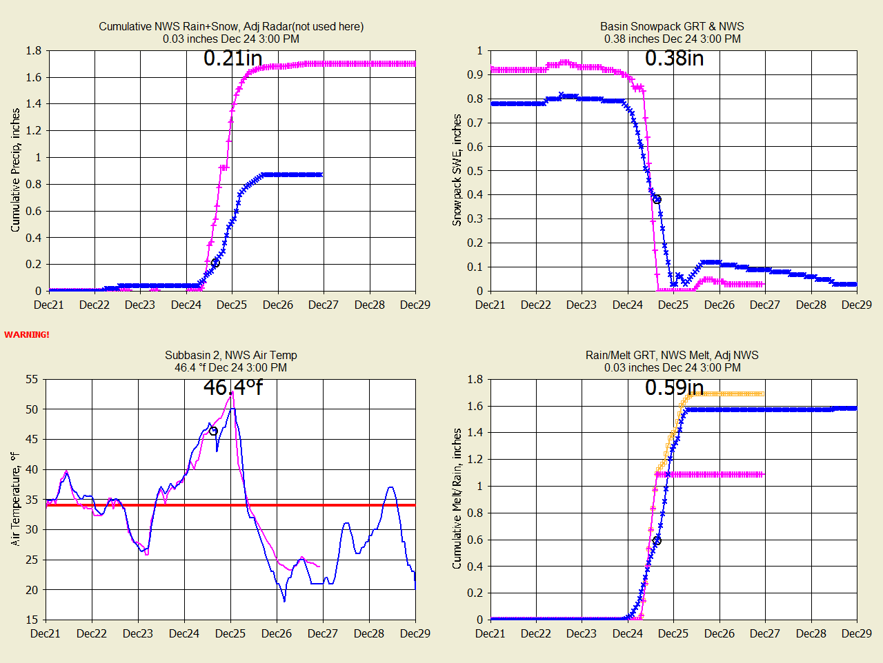
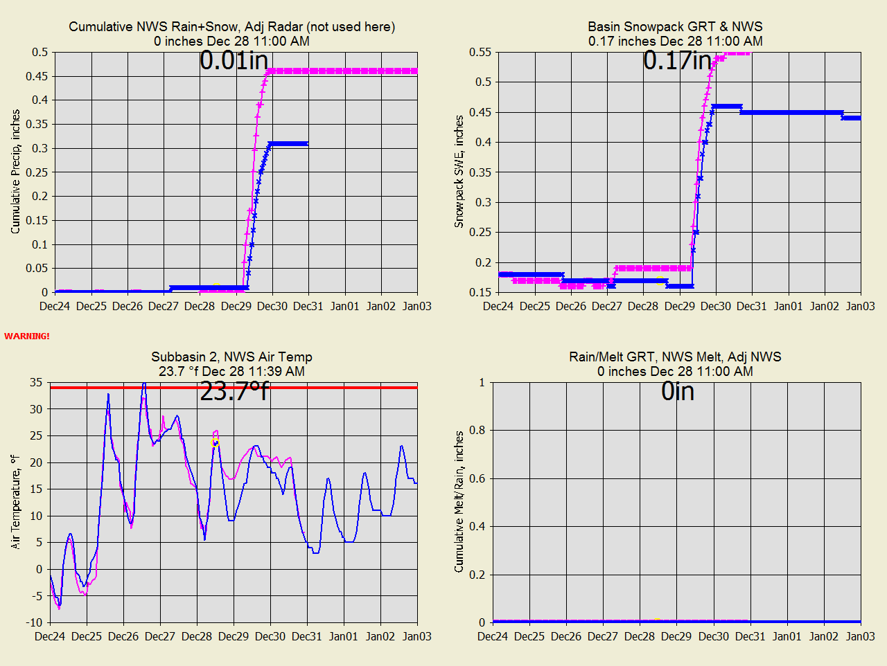
WC-Dec 28
NWS lower precip forecast than GRT.
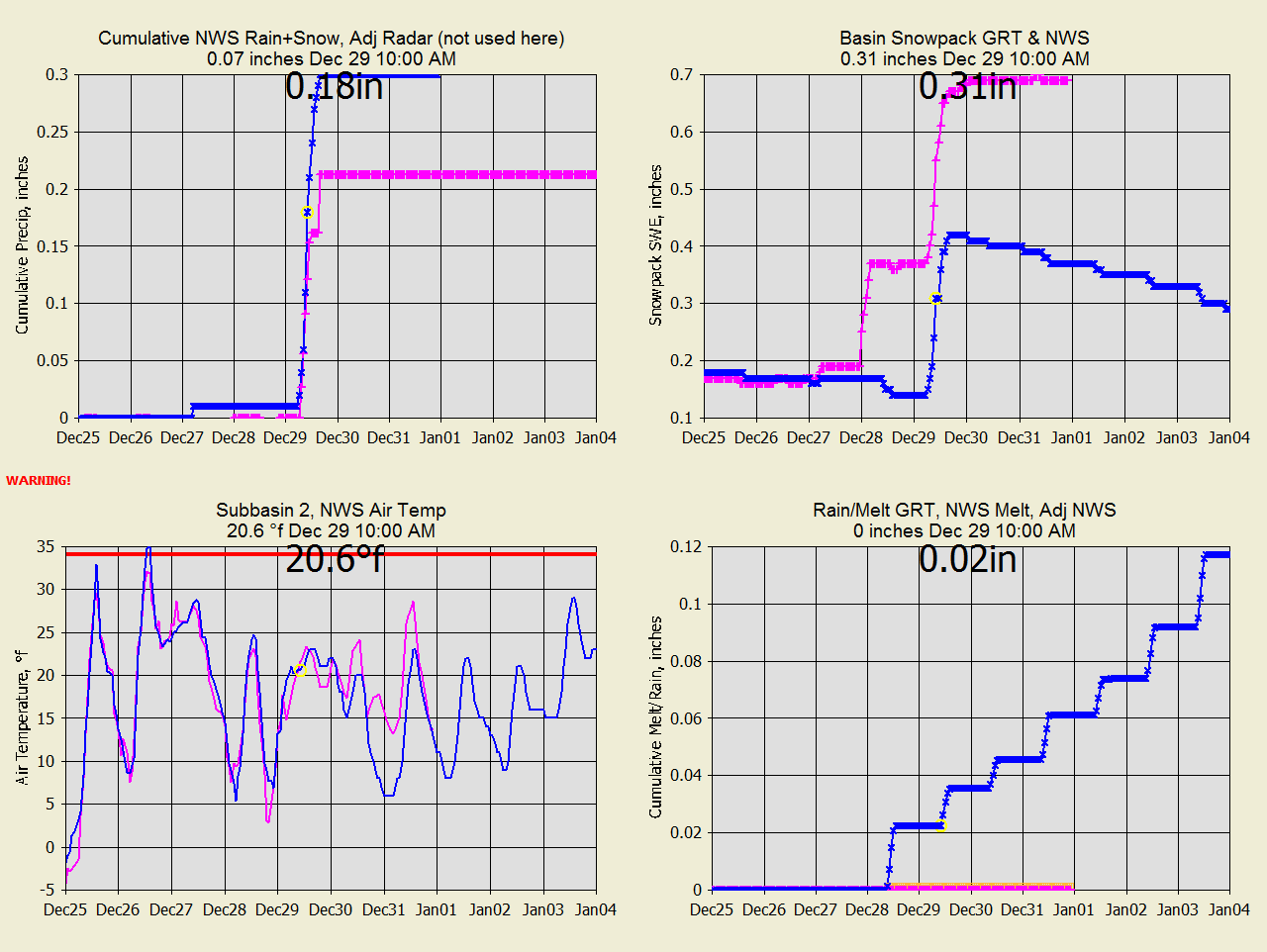
WC-Dec 29 NWS makes 0.2" snowpack out of zero precip on the 28th.
GRT is melting below freezing.
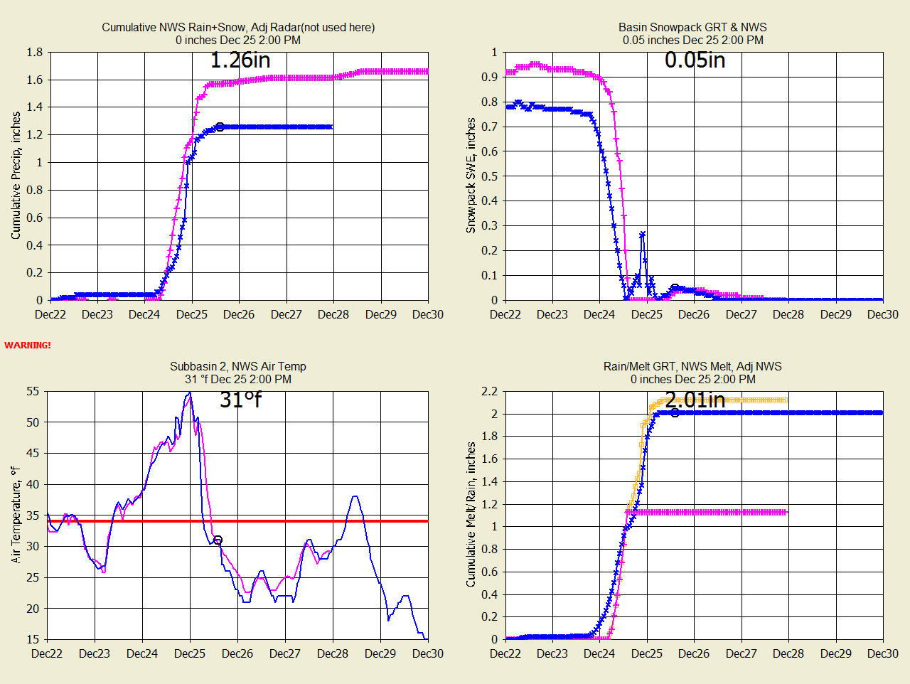
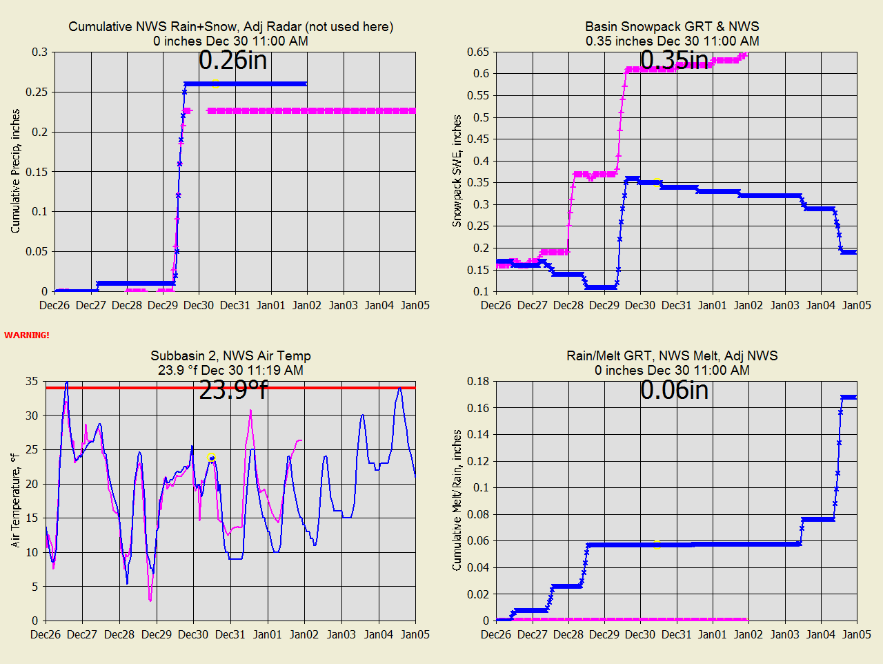
WC-Dec 30, 2020
I "fixed" GRT's solar melting below 30F. I don't think freezing snow melt
would travel far anyway.
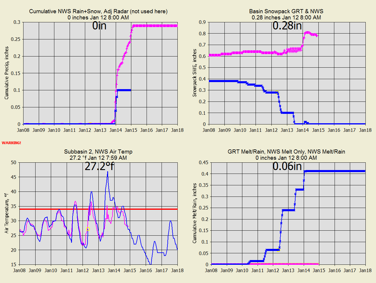
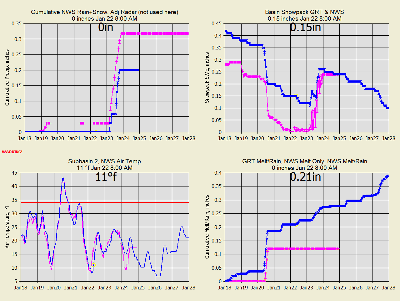
WC-Jan
2, 2021 Somehow NWS got a snowpack increase on Dec 28 so now watching melt
diverge.
WC-Jan 6, 2021 GRT reset Dec 2 swe to 0.6 arbitraily to match NWS arbitrainess.
WC-Jan
12, 2021 GRT says melt it all, NWS says 0 melt and snowpack it all.
GRT 3 times NWS precip forecast. Temperatures have big difference.
WC-Jan
14, 2021 GRT's Jan 13 temps were correct, NWS was way low. Can't say
which history melt is right.
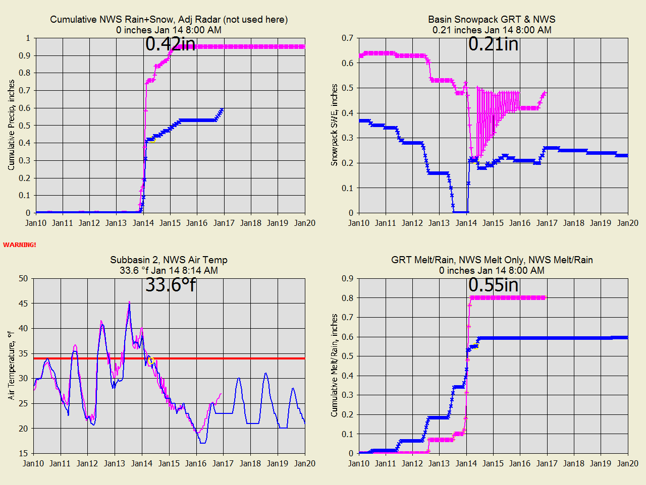
WC-Jan
19, 2021 NWS forecast Jan 20 temp is probably again WAY low with no melt.
WC-Jan 22, 2021 GRT had the temp right and webcams still show plenty of snow.
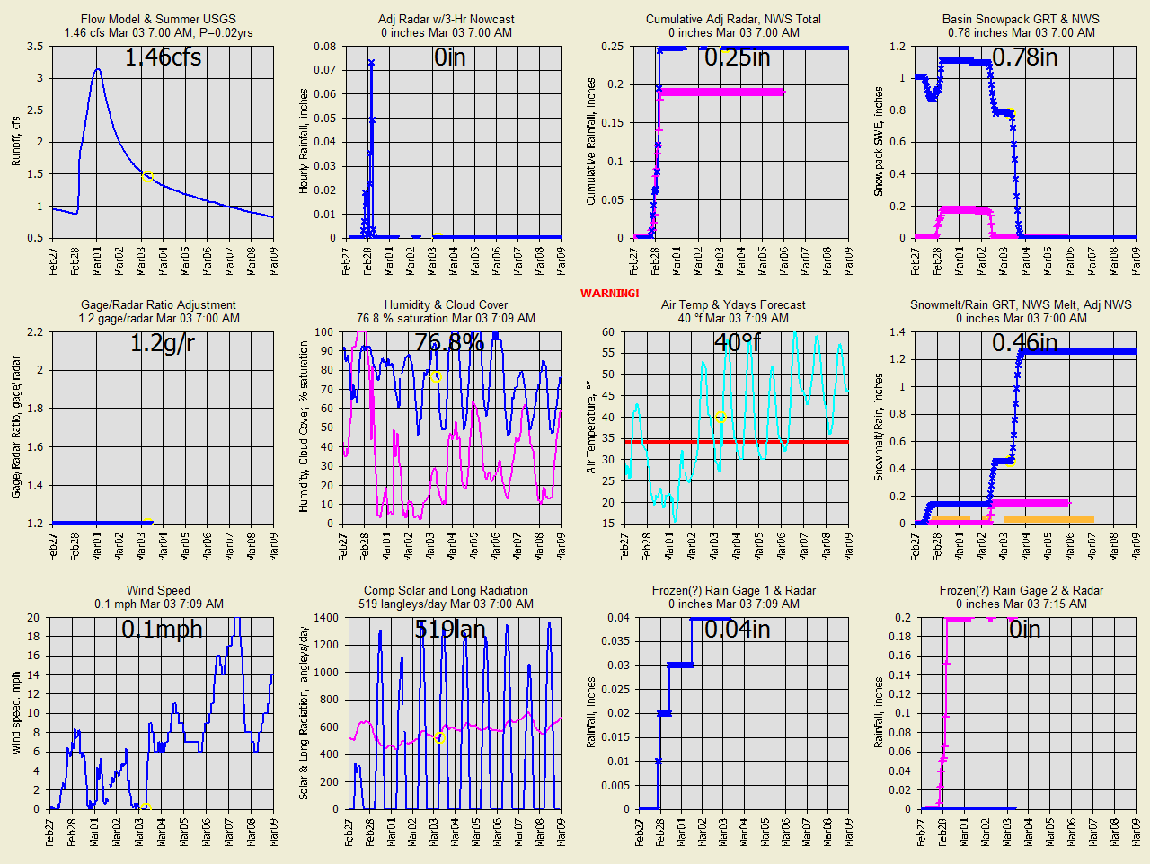
WC-Mar
3, 2021 GRT was late melting.
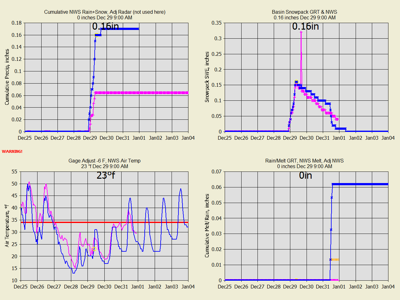
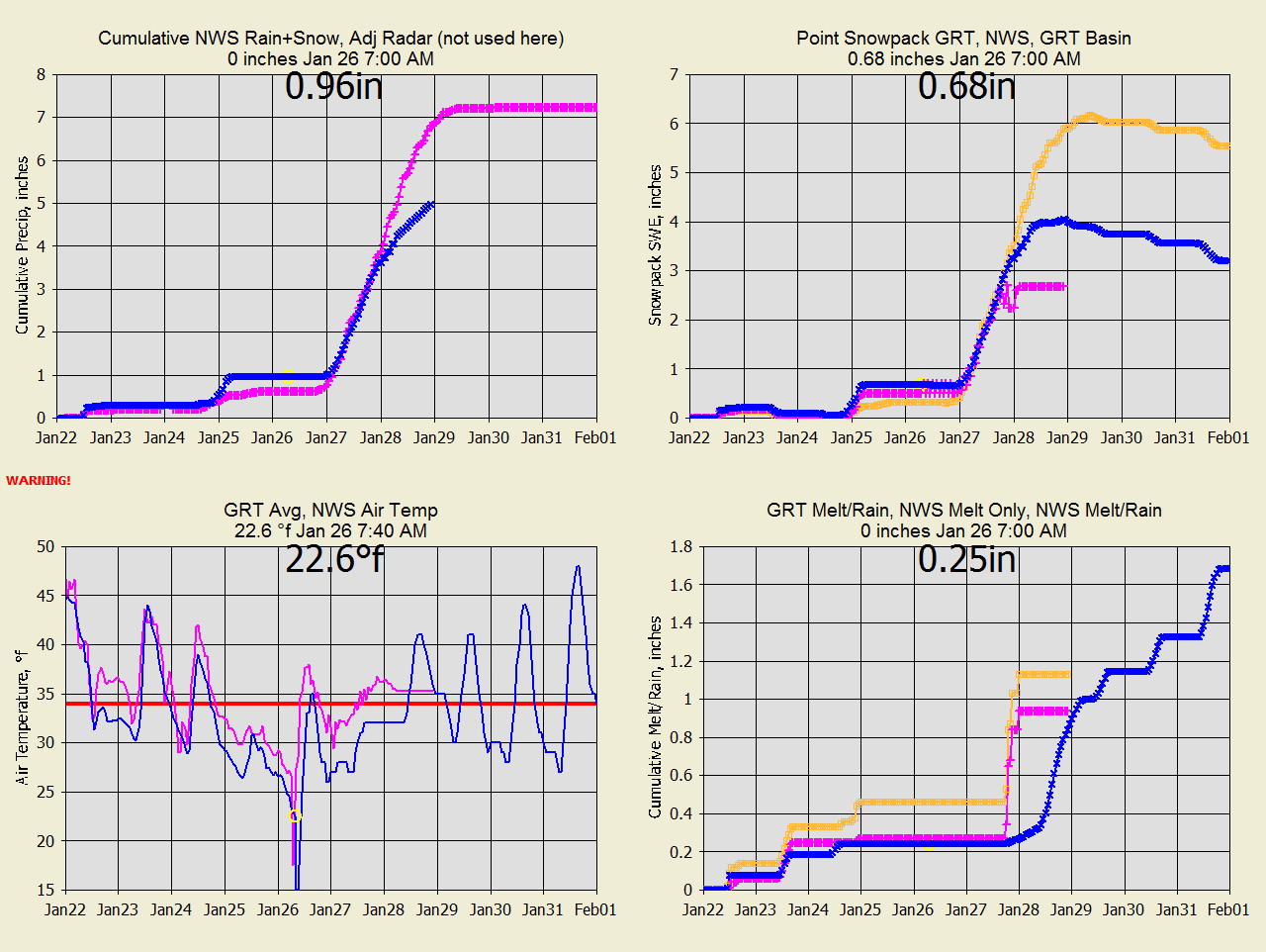
SC Dec 28, 2020 NWS precip forecast is 1/2 of GRT.
NWS forecast temp is much cooler than GRT.
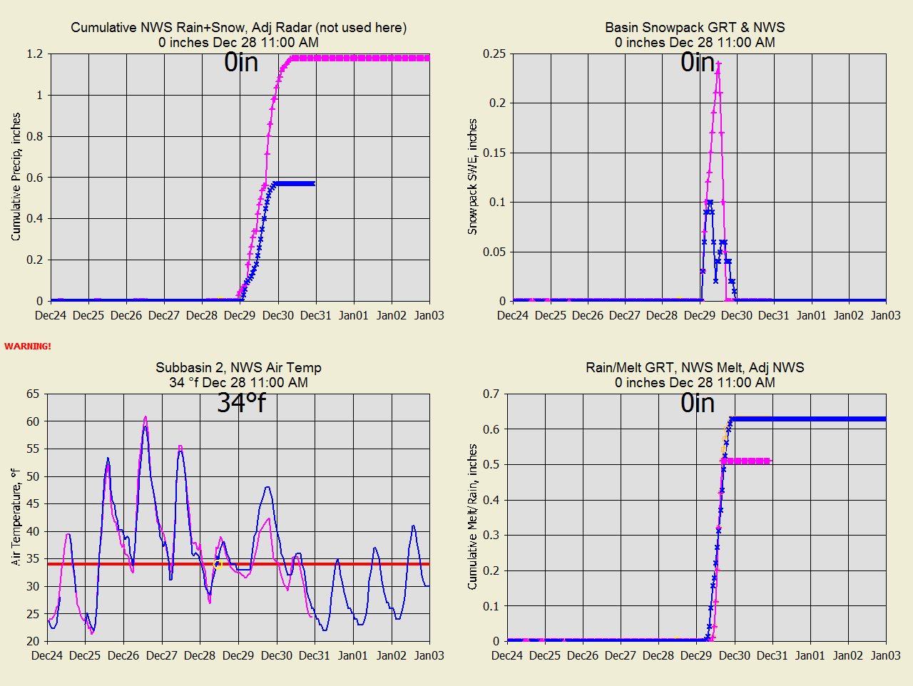
SC Dec 29, 2020 NWS precip forecast is still 1/2 of GRT.
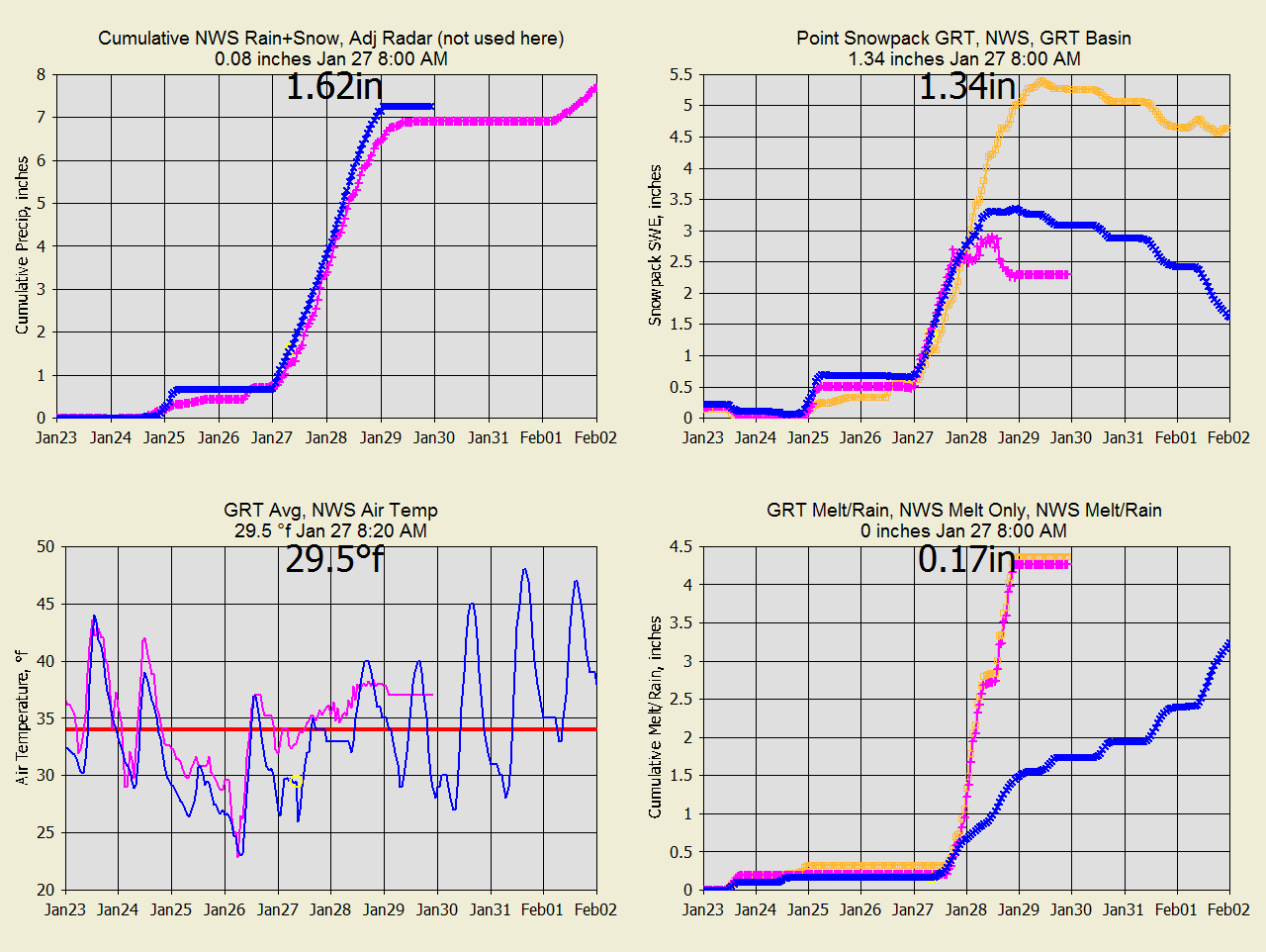
SC Dec
30, 2020 Precip now agrees with GRT.
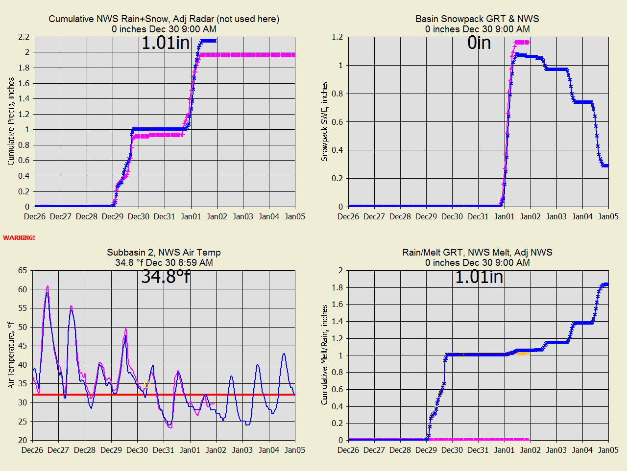
SC
Jan 2, 2021 Precip now agrees with GRT.
SC
Jan 2, 2021 NWS shows no melt at 47F on the 3rd.
RC Dec 28, 2020
NWS doesnt give a SWE forecast.
RC Dec 29, 2020 GRT has higher melt temp on 31.
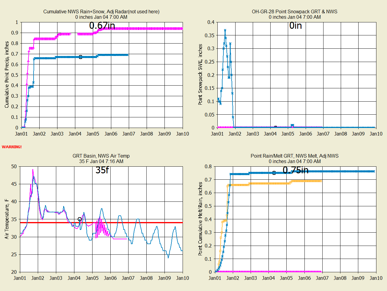
MC Dec 31, 2021
Looks ok.
MC Jan 1, 2021 big difference in Temp. NWS has no melt at 50F...
and no data on web pages.
MC Jan
2, 2021 continues big difference in Temp forecast and snowpack.
MC Jan
4, 2021 GRT won Temp forecast but who knows about Jan 1 snowpack when NWS
deletes it.
RR Jan
12, 2021 Snowpack set to same several days ago. Everything is different
for the forecast 13-14 melt.
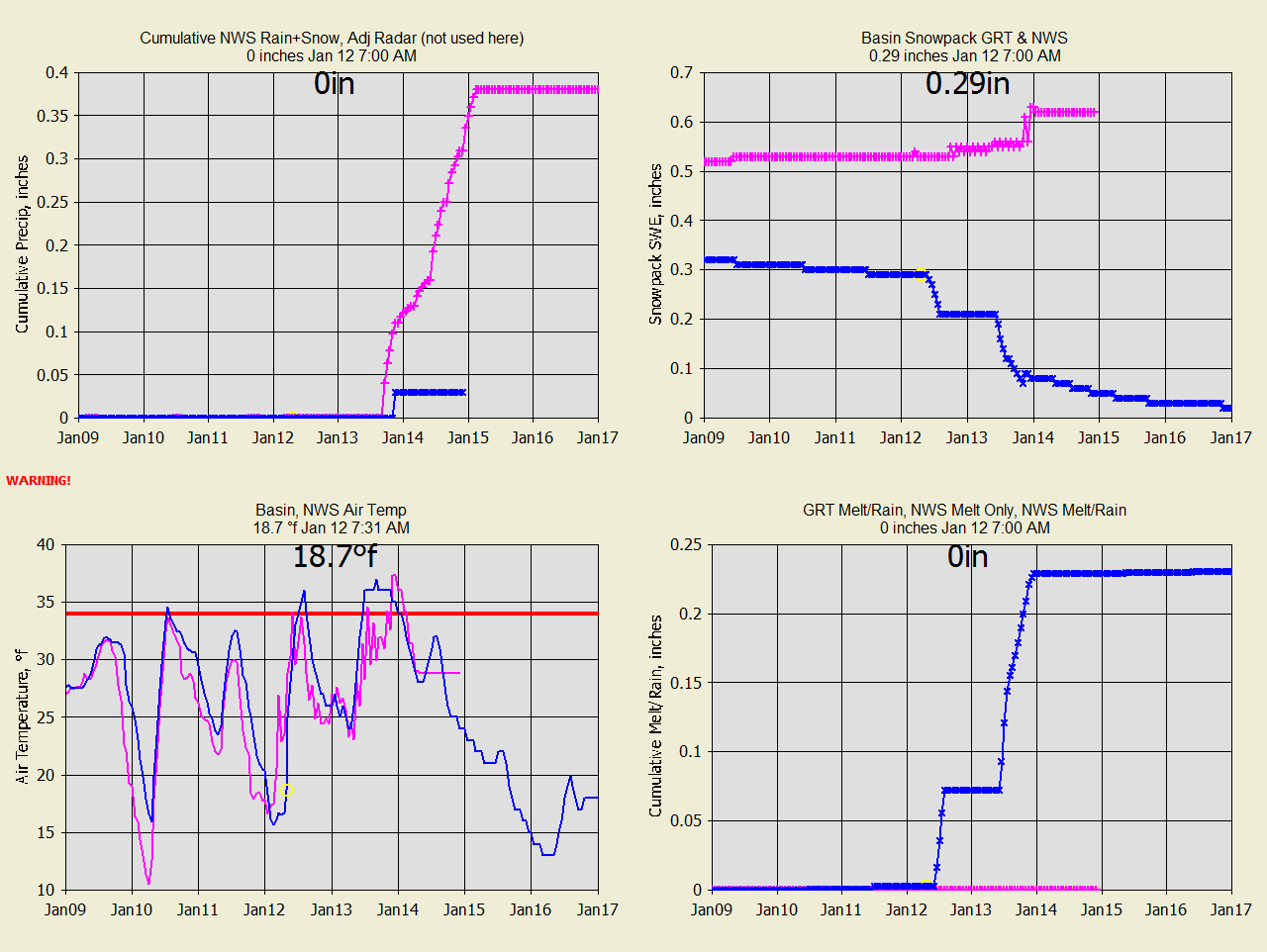
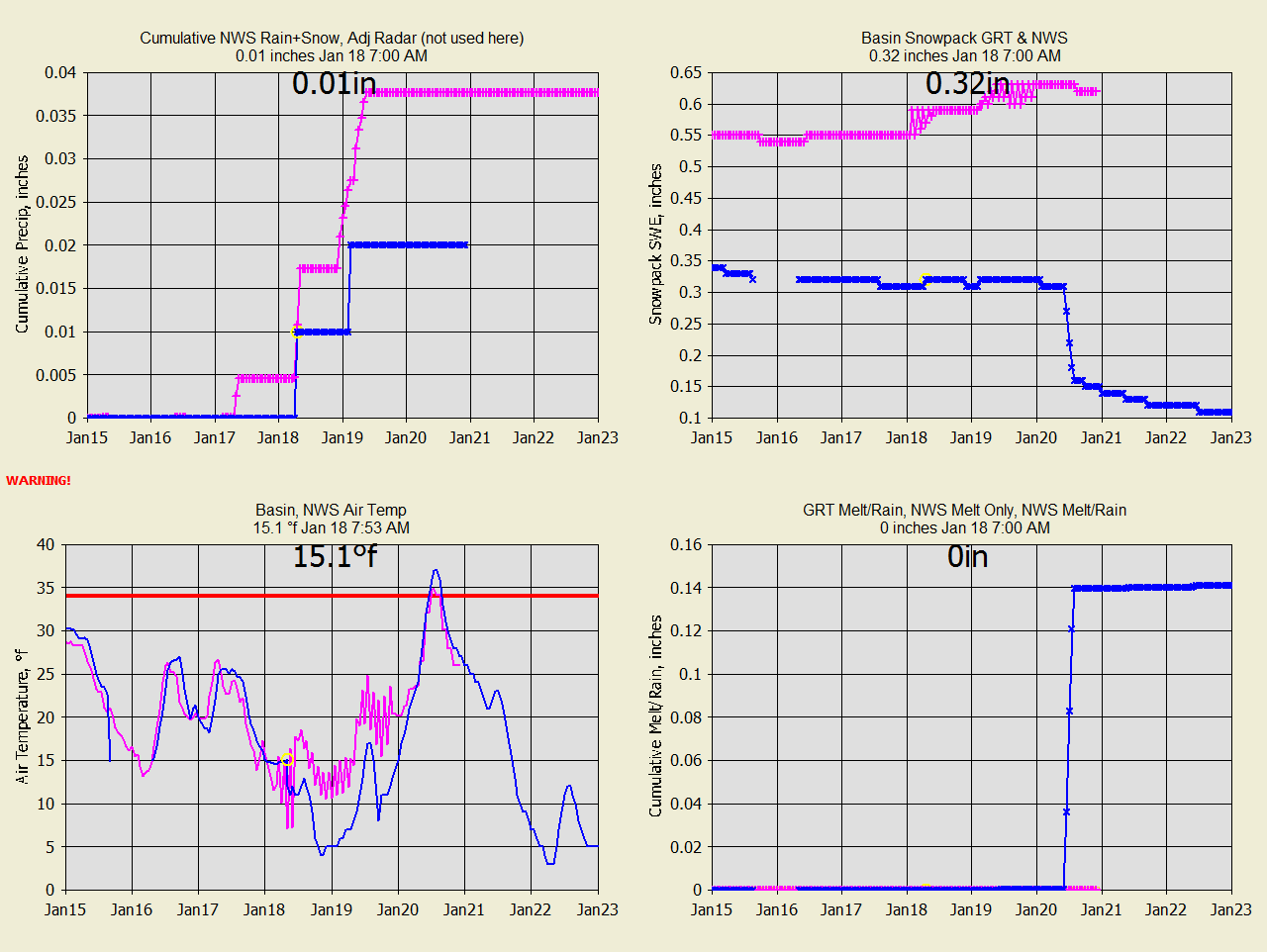
RR Jan
18, 2021 Stayed frozen so far. GRT had the better precip forcast for Jan
12-13.
RR Feb
20, 2021 GRT says the melt starts today. NWS not so much. GRT may
need less dirty snow adjust.
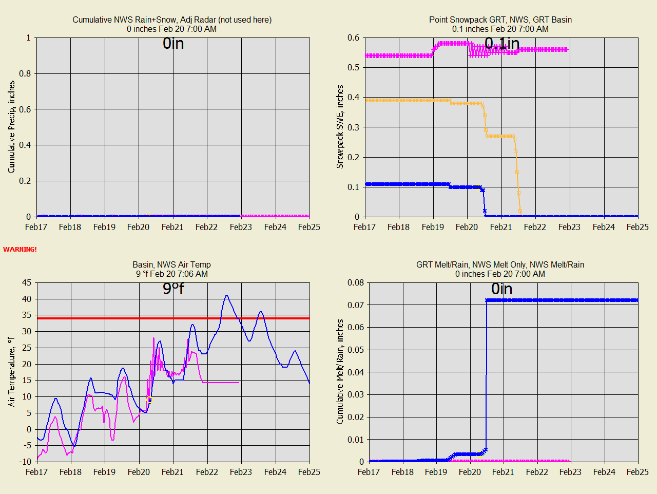
RR Feb 22, 2021 GRT was right. NWS is covering both sides of the street.

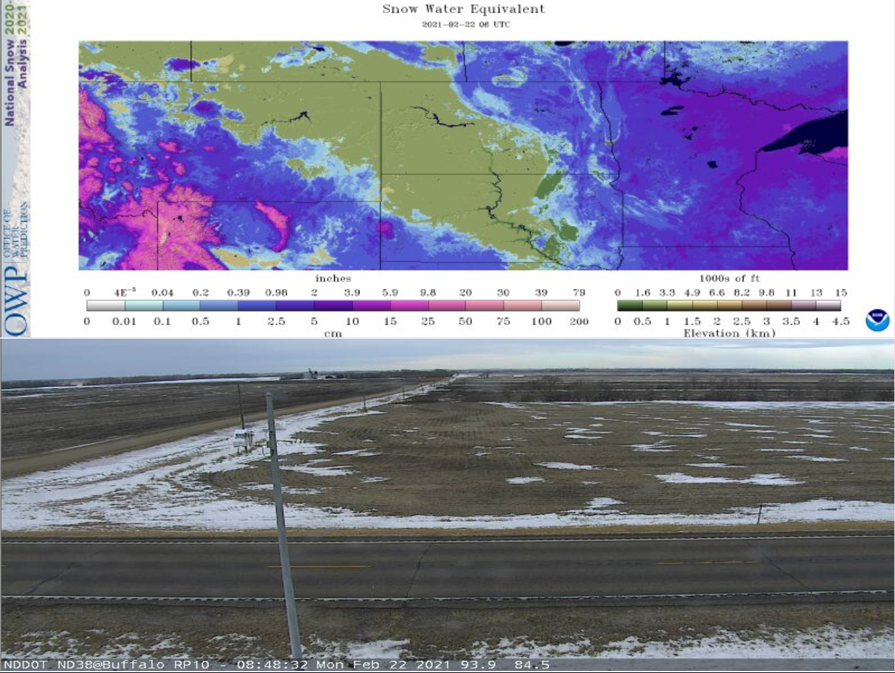
RR Jan
22, 2021 Heres a field a mile or 2 south of the Rush River basin.
BC Jan
26, 2021 6" forecast, that's like 6 ft of snow!!!
BC Jan
27, 2021 6" forecast continues. Watch the melt Jan 28 difference.
BC Jan
28, 2021 NWS has higher Temps with little snow accumulation.
BC Jan
29, 2021 NWS temperatures were correct based on runoff. GRT temps were not
even close.
This is California Sierra foothills so something odd about California.
Either all melt or all snow +5.75F.
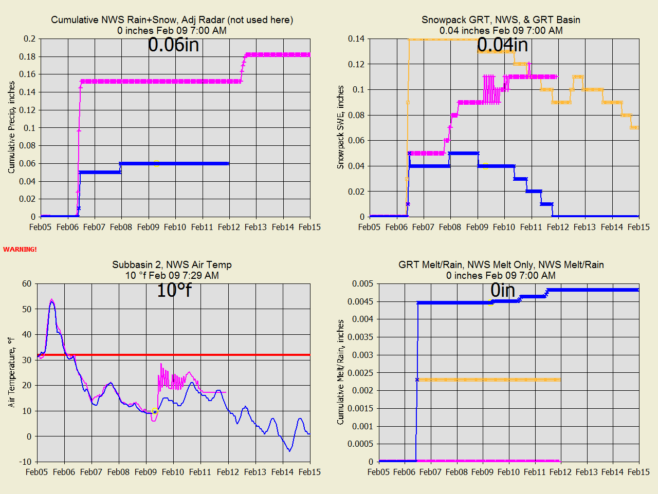
SC Feb 09, 2021
GRT better A2M radar precip based on Wichata webcam.
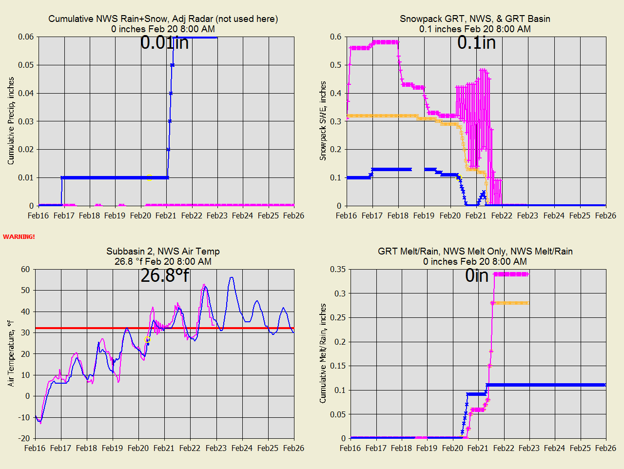
SC Feb 20, 2021 Finally might melt. NWS has mysterious snowpack sources.
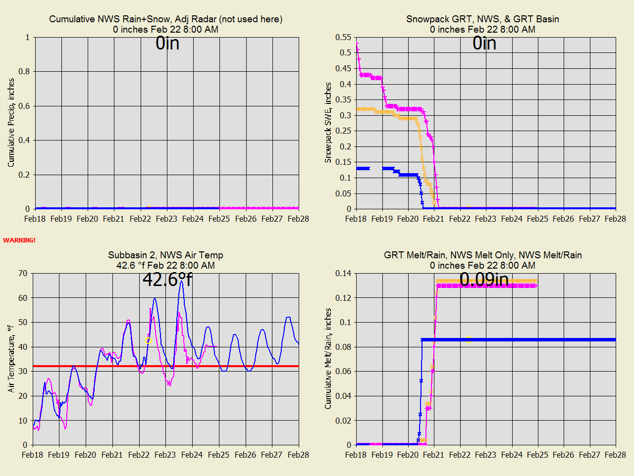
SC Feb 22, 2021 Finally melted.
Both seem ok compared to runoff timing.
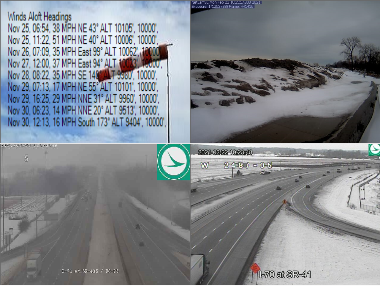
MC Feb 22, 2021 NWS has no/yes snowpack but pics below say otherwise.
MC Feb 22, 2021 NWS has little snowpack but pics say otherwise.
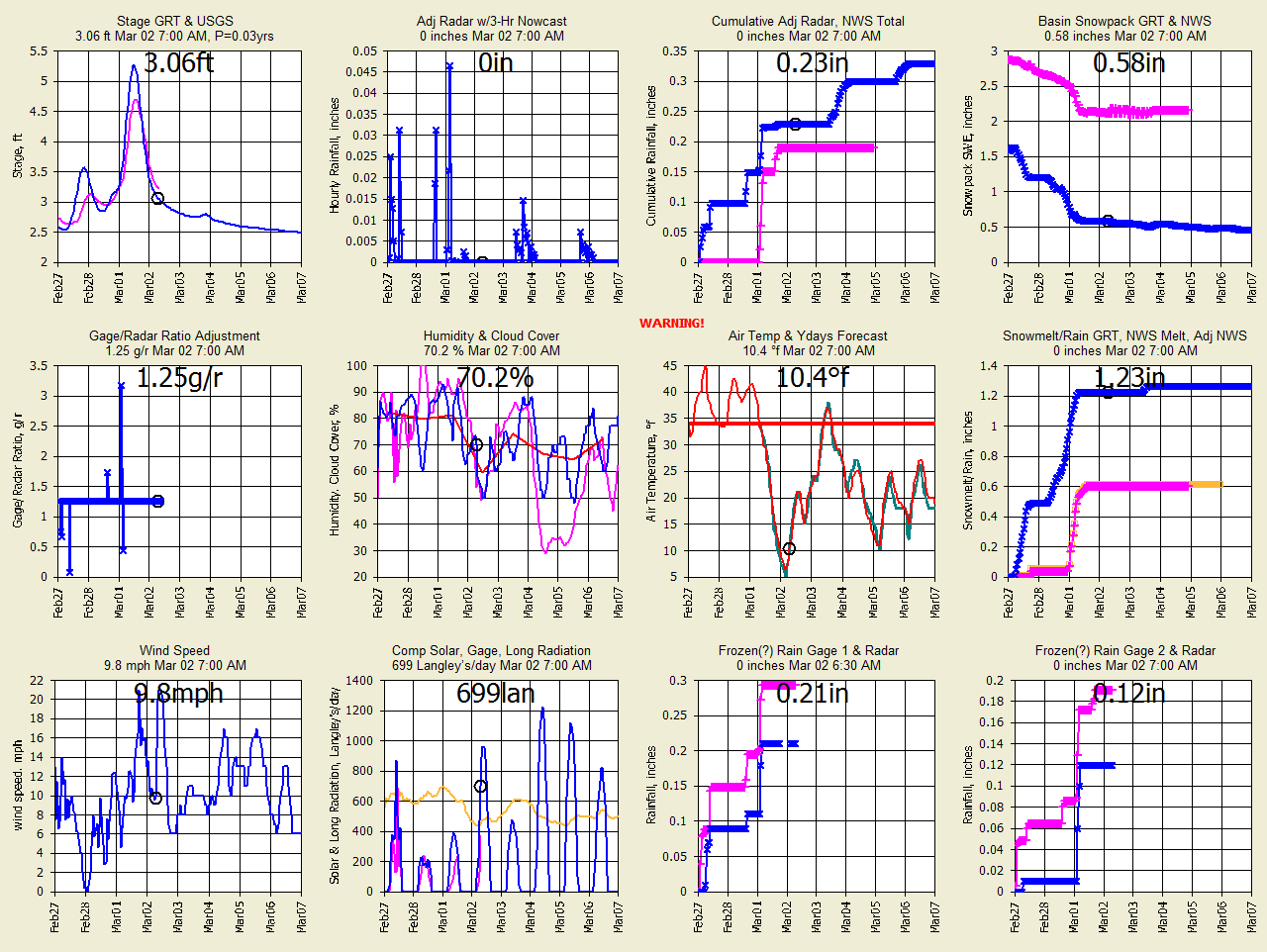
OC
Mar 2, 2021
Finally beginning to melt. NWS winter snowpack 3" vs 1.5" GRT. Watch
stage graph for melt timing.
OC
Mar 11, 2021
GRT had good melt pattern but only half the snowpack to melt. NWS had poor
melt pattern.
LESSONS LEARNED:ong>LESSONS LEARNED:
1) Dec 2, 2020 My long radiation needs a 0.9 correction factor.
Only at BC because of a different temp. All other sites need a 1.0 long
adjust and a 1.15 windspeed adjust based on a 12' to 30' gage height
guesstimate. Wind Speed is a good candidate for calibration because of the
relatively large amount of sensible heat flux compared to solar, long, and
latent. You can inspect all 4 flux by setting a print flag (see Help
page).
2) Dec 10, 2020 The A2M radar is woefully under estimating and overshooting the
snowfall. You can't adjust a zero radar value so maybe better to us the
NWS Point rain+snow for basin precip. Never say you can't because now you
can adjust the 5-min radar by using the gage average/12 when radar is zero (see
Help web page). I like the 7 day forecast with GRT
snowmelt on that better than the short 2-day NWS point forecast that gets
truncated mid melt.
3) Dec 10, 2020 I'll keep the A2M radar as is for now just to prove the point of
how poor it is and NWS Snowcast or NWS Forecasat point precip is much preferred
at sites with no heated gage.
4) The
NWS
(nohrsc) forecast of precip could be using the HRRR 18 hour forecast
and may be why the difference from the NWS 7-day forecast GRT uses. For
high rainfall events I've found the 7-day forecast for the next 3 hours to be
better than the HRRRR. GRT's 3-hr Nowcast of radar precip is usually the
best.
Links to the web pages used in this studay:
MC=Massies Creek, OH
OC=Oneida Creek, NY
SC=Slate Creek, KS
RC=Rapid Creek, SD
WC=Willow Creek, SD
RR=Rush River, ND
BC=Big Creek, CA
WEBSITE MAP


WU USGS USBR USCS CWRD NWS
More Free Downloads
Comments/Questions
Contact Me
Label
|