|
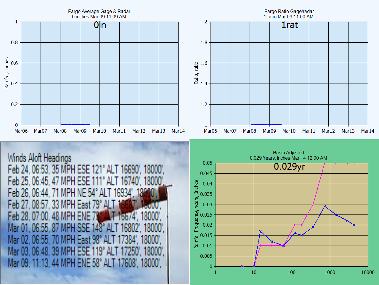
source: Intellicast/Wunderground
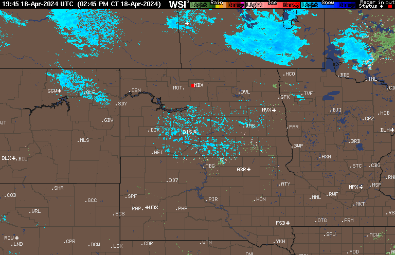
Current
radar reflectivity loop above. Beginning Oct 26, 2020 the MRMS radar product A2M is used with out rain
gage adjustment (maybe?). There isn't a heated gage in the area apparently so I'll
try the A2M but results for other locations in the past were pretty bad.
We will see how it does here. Maybe KFAR airport heated gage will work
here
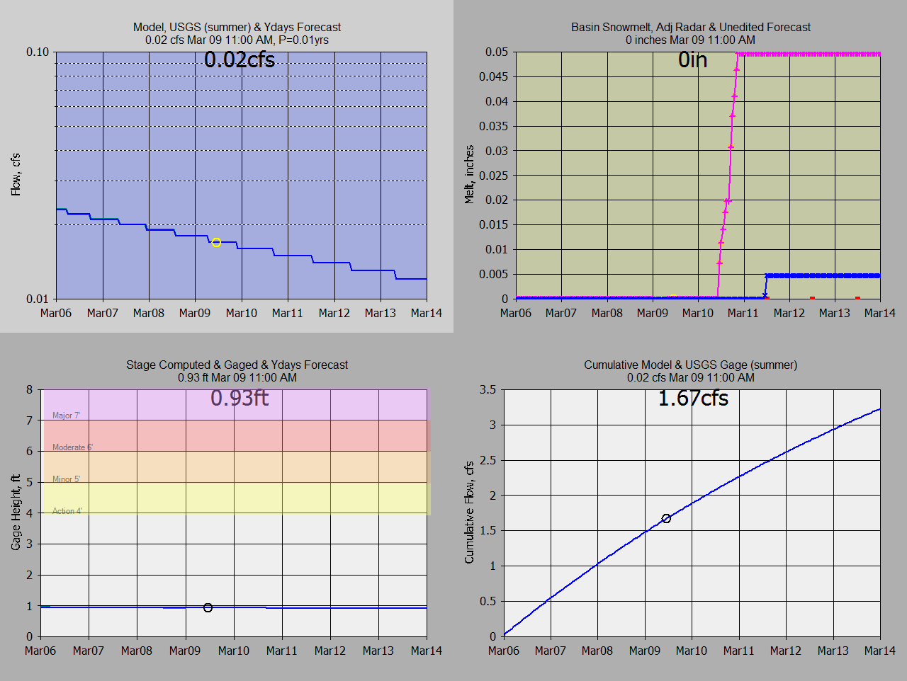
NWS Model Point 0164N8 Compared to GRT Using NWS Rain+Snow Precip:

NOTE ALL TIMES ARE FOR MY PACIFIC TIME ZONE
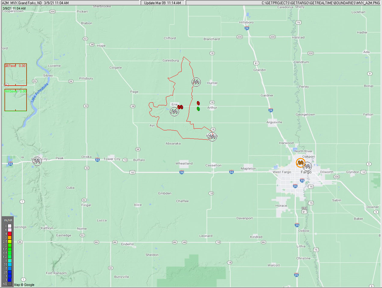
Current automated graphs and radar (updated when runoff)
NWS Model Point 0164N8 Compared to GRT Using NWS Rain+Snow Precip:
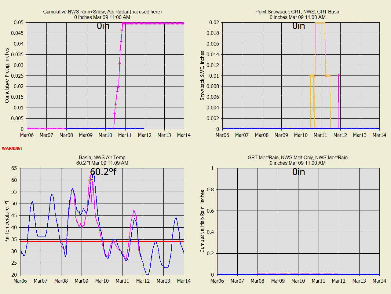
Summary of Snowmelt (Series 1=Blue, Series 2=Pink, Series 3=Orange):
Radar ratio adjusted rainfall and
Wundergages (pink is second source referred to) :
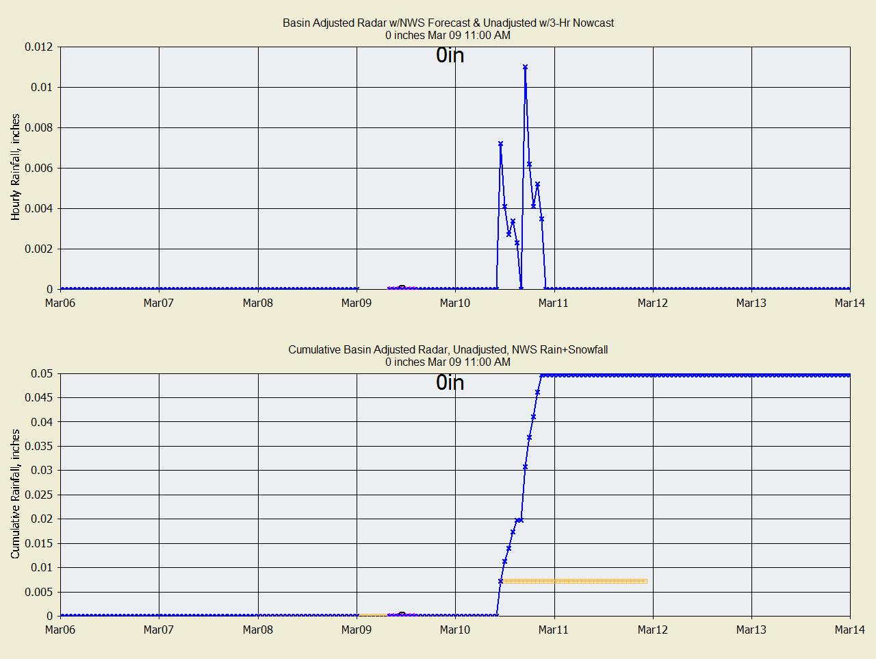
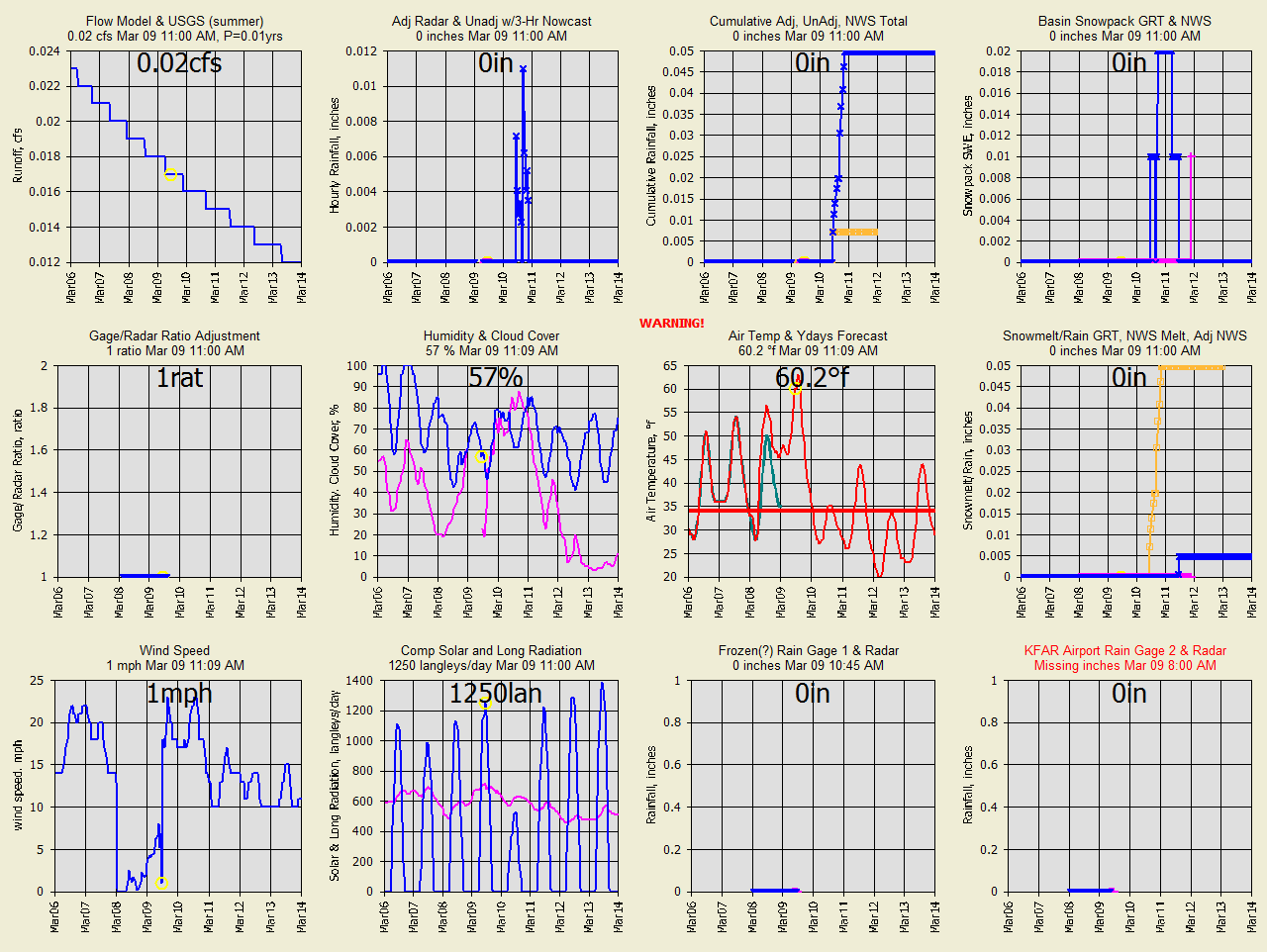
Subbasin runoff (2nd series is pink, 3rd is orange):
Wundergages and radar ratio adjustment:
Meteorlogical data from Wundergages for snowmelt and evapotranspiration used by
GRT:
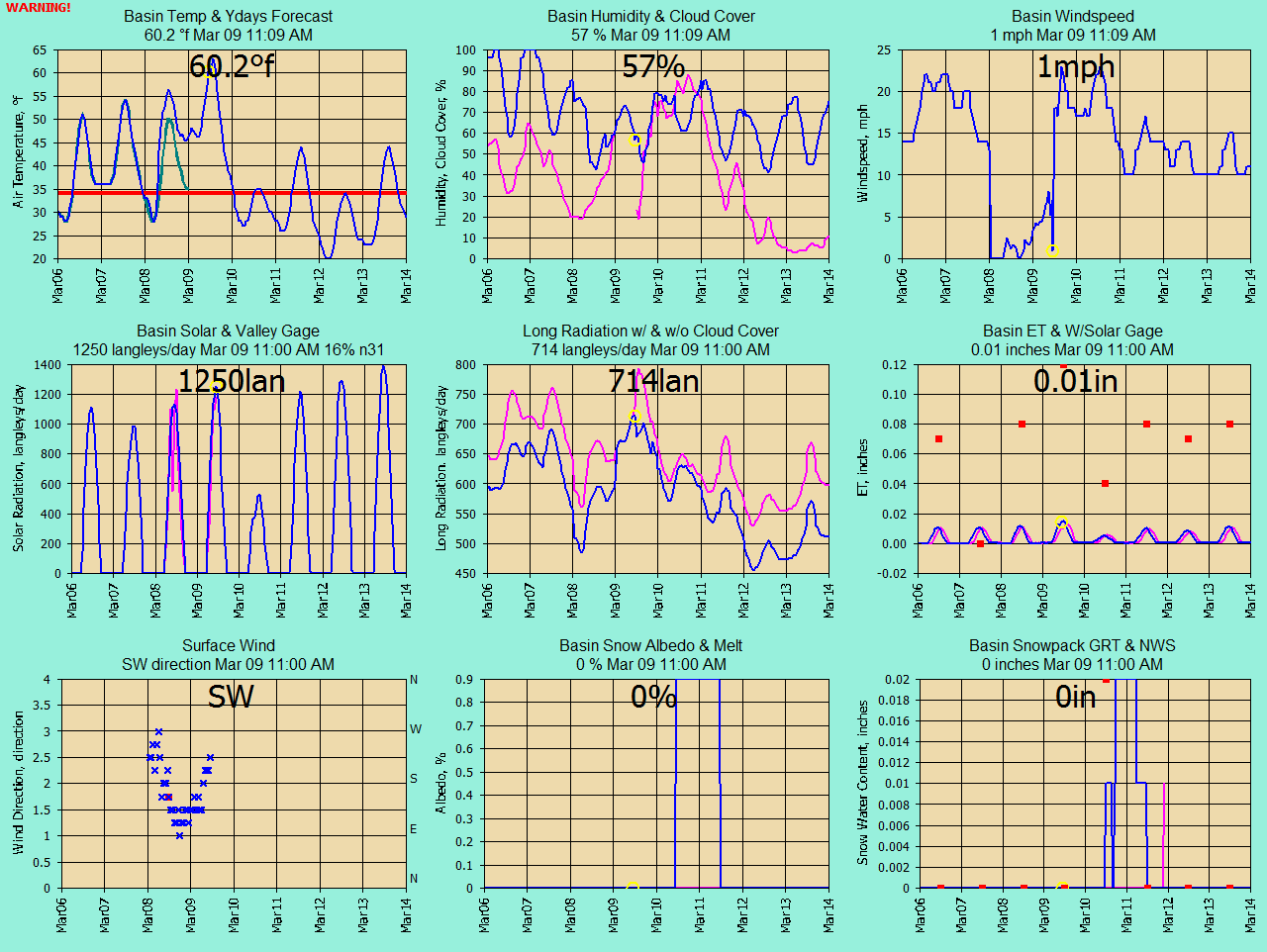
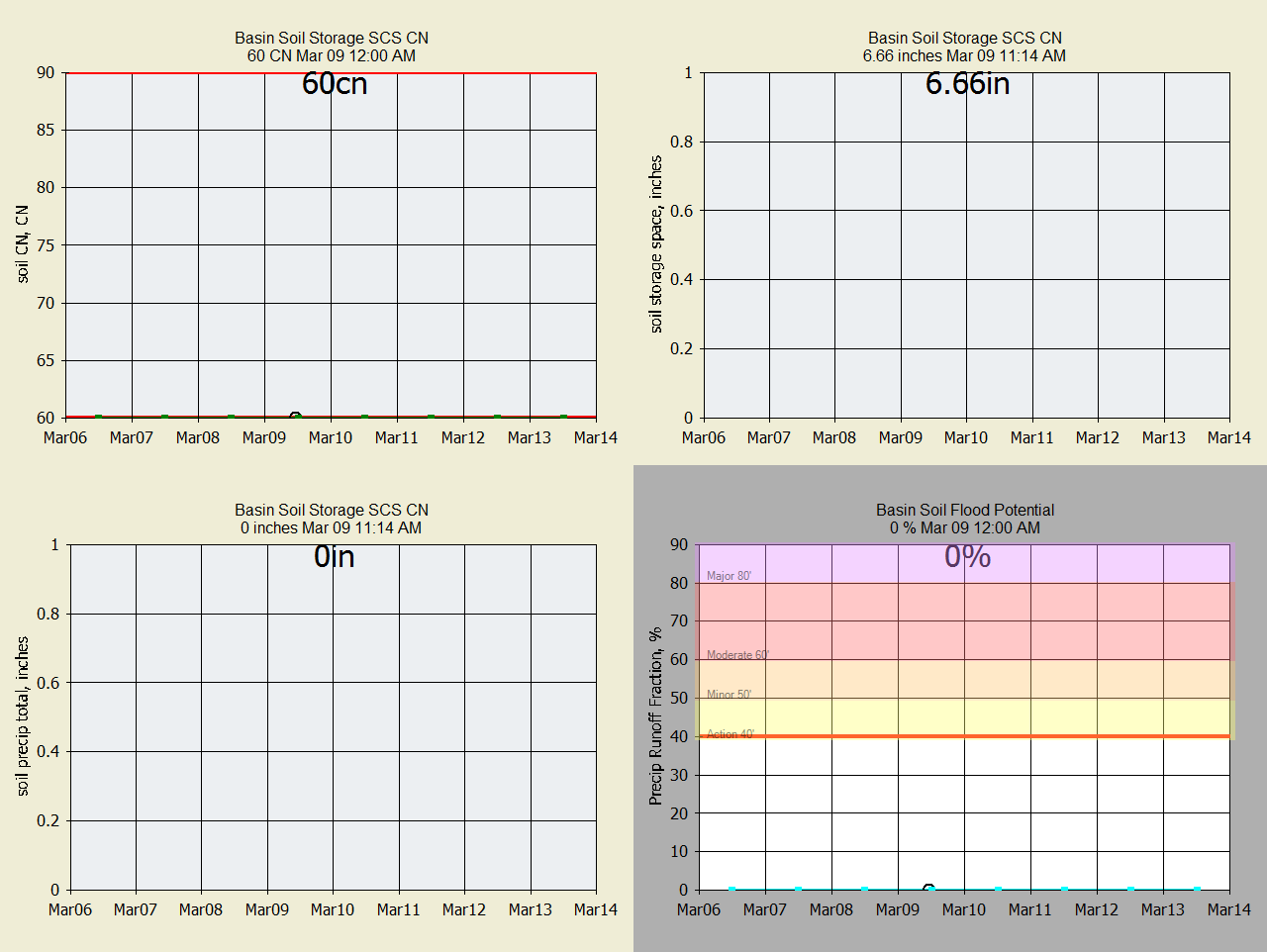
Soil moisture info used by GRT:
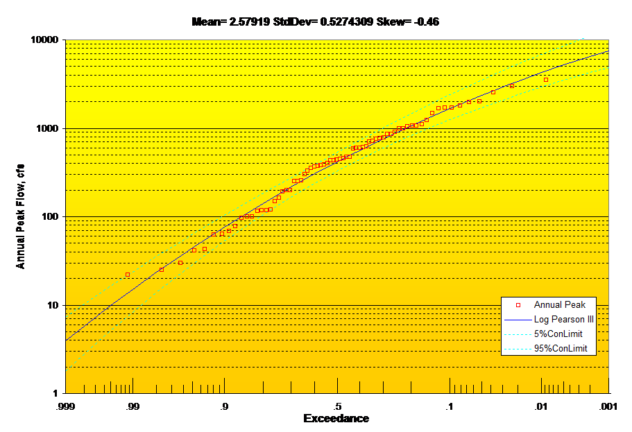
Rush River Log
Pearson III Annual Peak Flow Probability Distribution:
Past runoff comparisons for the 3 subs and routed basin runoff:
Important Note: Nothing on this page is intended as
interpretation of any legal authority such as water rights and supply. This page
is intended solely as a demonstration of techniques in flood potential
monitoring. The reader assumes all risk for any damages whatsoever in connection
with the access, use, quality, or performance of the supplied data just so you
know.
|